Star Communities
Star Communities is an office in Washington, D.C., Mid-Atlantic which is located on 1st Street Northeast. Star Communities is situated nearby to the government office DC Public Schools, as well as near District Department of the Environment.| Tap on a place to explore it |
Places of Interest Nearby
Highlights include United States Capitol and National Postal Museum.
United States Capitol
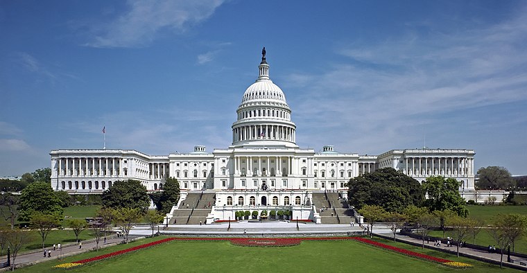
Photo: Ottojula, Public domain.
The United States Capitol, often called the Capitol or the Capitol Building, is the seat of the United States Congress, the legislative branch of the federal government. United States Capitol is situated 1 mile south of Star Communities.
National Postal Museum
Museum
 The National Postal Museum, located in Washington, D.C., is the primary postal museum of the United States. It covers large portions of the postal history of the United States and other countries. National Postal Museum is situated 2,900 feet south of Star Communities.
Union Station

Photo: VeggieGarden, CC BY-SA 4.0.
Washington Union Station, known locally as Union Station, is a major train station, transportation hub, and leisure destination in Washington, D.C. Designed by Daniel Burnham and opened in 1907, it is Amtrak's second-busiest station and North America's 13th-busiest railroad station. Union Station is situated 3,000 feet south of Star Communities.
Places in the Area
Nearby places include NoMa and Eckington.
NoMa
Neighborhood

Photo: AgnosticPreachersKid, CC BY-SA 3.0.
NoMa is a neighborhood of Washington, D.C., located in Ward 6 of the city. The neighborhood encompasses the region north of Massachusetts Avenue located north and east of Union Station.
Eckington
Neighborhood
 Eckington is a neighborhood in Northeast Washington, D.C., located south of the Prospect Hill and Glenwood Cemeteries. Eckington is less than one mile southeast of Howard University and exactly one mile north of the United States Capitol.
Shaw

Photo: Ron Cogswell, CC BY 2.0.
Shaw is a neighborhood in north-central Washington D.C. just east of Dupont Circle and south of Adams Morgan and Columbia Heights. Although it has a diverse population, Shaw is distinctive from the adjacent areas due to its African-American heritage.
Star Communities
- Type: Office
- Address: 1200 1st Street Northeast, Washington, 20002
- Location: Washington, D.C., Mid-Atlantic, United States, North America
- View on OpenStreetMap
Latitude
38.90593° or 38° 54′ 21″ northLongitude
-77.00629° or 77° 0′ 23″ westOpen location code
87C4WX4V+9FOpenStreetMap ID
node 2700443497OpenStreetMap feature
office=nonprofit
This page is based on OpenStreetMap, Wikidata, and Wikimedia Commons.
We’d love your help improving our open data sources. Thank you for contributing.
Satellite Map
Discover Star Communities from above in high-definition satellite imagery.
Notable Places Nearby
Highlights include DC Public Schools and District Department of the Environment.
Nearby Places
Explore places such as CVS Pharmacy and 88 M Construction.
Washington, D.C.: Must-Visit Destinations
Delve into West End, Georgetown, East End, and Shaw.
Curious Offices to Discover
Uncover intriguing offices from every corner of the globe.
About Mapcarta. Data © OpenStreetMap contributors and available under the Open Database License". Text is available under the CC BY-SA 4.0 license, except for photos, directions, and the map. Photo: Peterfitzgerald, CC BY-SA 3.0.