WEA NX-102 150kW
WEA NX-102 150kW is an electrical generator in Linsburg, Nienburg, Lower Saxony. WEA NX-102 150kW is situated nearby to the railway station Linsburg station, as well as near the forest Linsburger Bauernbruch.| Tap on a place to explore it |
Places of Interest Nearby
Highlights include Linsburg station and Giebichenstein boulder.
Linsburg station
Railway station

Photo: Clic, CC BY-SA 4.0.
Linsburg station is a railway station located in Linsburg, Germany. The station is located on the Wunstorf–Bremen railway line. The train services are operated by Transdev Hannover as part of the Hanover S-Bahn. Linsburg is served by the S2. Linsburg station is situated 210 metres east of WEA NX-102 150kW.
Giebichenstein boulder
Stone
The Giebichenstein near Stöckse, Germany, in the district of Nienburg, Lower Saxony, is one of the largest erratic boulders of northern Germany. It weighs around 207 tonnes. Giebichenstein boulder is situated 3½ km north of WEA NX-102 150kW.
Großsteingrab Stöckse
Archaeological site
 Großsteingrab Stöckse is an archaeological site, which is situated 3½ km north of WEA NX-102 150kW.
Places in the Area
Nearby places include Linsburg and Stöckse.
Stöckse
Village
Stöckse is a municipality in the district of Nienburg, in Lower Saxony, Germany. It is situated in the forest "Krähe" between Langendamm and Steimbke. Stöckse is situated 4½ km north of WEA NX-102 150kW.
Husum
Village
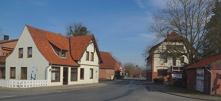
Photo: flamenc, CC BY-SA 3.0.
Husum is a municipality in the district of Nienburg, in Lower Saxony, Germany. Husum is situated 6 km southwest of WEA NX-102 150kW.
WEA NX-102 150kW
- Type: Electrical generator
- Category: industry
- Location: Linsburg, Nienburg, Lower Saxony, Germany, Central Europe, Europe
- View on OpenStreetMap
Latitude
52.60109° or 52° 36′ 4″ northLongitude
9.3221° or 9° 19′ 20″ eastOpen location code
9F4FJ82C+CROpenStreetMap ID
node 272113724
This page is based on OpenStreetMap, Wikidata, and Wikimedia Commons.
We’d love your help improving our open data sources. Thank you for contributing.
Satellite Map
Discover WEA NX-102 150kW from above in high-definition satellite imagery.
Notable Places Nearby
Highlights include Linsburger Bauernbruch and Freiwillige Feuerwehr Linsburg.
Nearby Places
Explore places such as Fred Dannenberg and Hauptsaat GmbH.
Lower Saxony: Must-Visit Destinations
Delve into Hanover, Göttingen, Brunswick, and Wolfsburg.
Curious Electrical Generators to Discover
Uncover intriguing electrical generators from every corner of the globe.
About Mapcarta. Data © OpenStreetMap contributors and available under the Open Database License". Text is available under the CC BY-SA 4.0 license, except for photos, directions, and the map. Photo: Danapit, CC BY-SA 3.0.