Da Junta
Da Junta is a café in Vila Franca, Viana do Castelo. Da Junta is situated nearby to the town hall Junta de Freguesia de Vila Franca, as well as near the village Mazarefes.| Tap on a place to explore it |
Places of Interest Nearby
Highlights include Castelo de Portuzelo and Darque train station.
Castelo de Portuzelo
Castle
Castelo de Portuzelo is a castle in Portugal. It is classified by IGESPAR as a Site of Public Interest. Castelo de Portuzelo is situated 3½ km northwest of Da Junta.
Darque train station
Railway stop
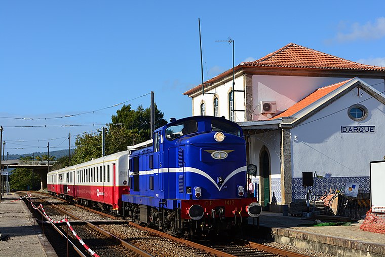
Photo: Nelso Silva, CC BY-SA 2.0.
Darque train station is a railway stop, which is situated 3 km west of Da Junta.
Quinta de São Cristóvão da Portela
Farm

Photo: Susana Pereira, CC BY-SA 3.0.
Quinta de São Cristóvão da Portela is a farm, which is situated 2 km south of Da Junta.
Places in the Area
Nearby places include Mazarefes and Darque.
Mazarefes
Village
Mazarefes was a civil parish in the municipality of Viana do Castelo, Portugal, with a population of 1 343 inhabitants. Since 2013, it was merged with the parish of Vila Fria, forming Mazarefes e Vila Fria.
Darque
Town
Darque is a civil parish in the municipality of Viana do Castelo, Portugal. The population in 2011 was 7,817, in an area of 9.01 km2. Darque is situated 4 km west of Da Junta.
Mujães
Village

Photo: Susana Pereira, CC BY-SA 3.0.
Mujães is a village, which is situated 4 km southeast of Da Junta.
Da Junta
- Type: Café
- Location: Vila Franca, Viana do Castelo, Viana do Castelo District, Portugal, Iberia, Europe
- View on OpenStreetMap
Latitude
41.68359° or 41° 41′ 1″ northLongitude
-8.74779° or 8° 44′ 52″ westOpen location code
8CHHM7M2+CVOpenStreetMap ID
node 2725706733OpenStreetMap feature
amenity=cafe
This page is based on OpenStreetMap, Wikidata, and Wikimedia Commons.
We’d love your help improving our open data sources. Thank you for contributing.
Satellite Map
Discover Da Junta from above in high-definition satellite imagery.
Notable Places Nearby
Highlights include Junta de Freguesia de Vila Franca and Povoado fortificado de Sabariz.
Nearby Places
Explore places such as Posto Farmaceutico and António da Silva Barros.
Portugal: Must-Visit Destinations
Delve into Lisbon, Caldas da Rainha, Porto, and Coimbra.
Curious Cafés to Discover
Uncover intriguing cafés from every corner of the globe.
About Mapcarta. Data © OpenStreetMap contributors and available under the Open Database License". Text is available under the CC BY-SA 4.0 license, except for photos, directions, and the map. Photo: bob, CC BY 2.0.