Kriegerdenkmal Trebsau
Kriegerdenkmal Trebsau is a memorial in Bechtsrieth, Neustadt an der Waldnaab, Bavaria. Kriegerdenkmal Trebsau is situated nearby to the church Ortskapelle, as well as near St. Josef.| Tap on a place to explore it |
Places of Interest Nearby
Highlights include St. Barbara and Heilige Staude.
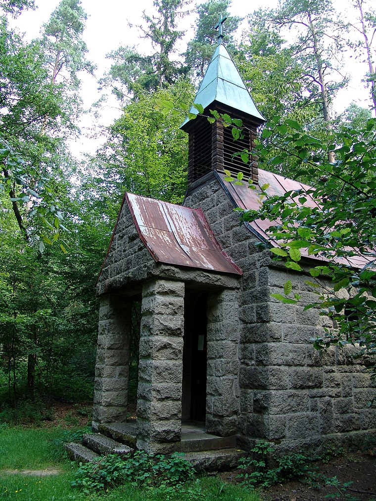
St. Barbara
Church

Photo: DALIBRI, CC BY-SA 4.0.
St. Barbara is a church, which is situated 2½ km southeast of Kriegerdenkmal Trebsau.
Heilige Staude
Church
 Heilige Staude is a church, which is situated 3 km northwest of Kriegerdenkmal Trebsau.
Auferstehung Christi
Church

Photo: DALIBRI, CC BY-SA 4.0.
Auferstehung Christi is a church, which is situated 3 km west of Kriegerdenkmal Trebsau.
Places in the Area
Nearby places include Unterhöll and Schirmitz.
Unterhöll
Hamlet

Photo: Allexkoch, CC BY-SA 4.0.
Unterhöll is a hamlet, which is situated 2½ km northeast of Kriegerdenkmal Trebsau.
Schirmitz
Village
 Schirmitz is a municipality in the district of Neustadt an der Waldnaab in Bavaria, Germany. Schirmitz is situated 3 km northwest of Kriegerdenkmal Trebsau.
Mitterhöll
Hamlet

Photo: Allexkoch, CC BY-SA 4.0.
Mitterhöll is a hamlet, which is situated 3 km northeast of Kriegerdenkmal Trebsau.
Kriegerdenkmal Trebsau
- Type: Memorial
- Category: historic site
- Location: Bechtsrieth, Neustadt an der Waldnaab, Upper Palatinate, Bavaria, Germany, Central Europe, Europe
- View on OpenStreetMap
Latitude
49.63906° or 49° 38′ 21″ northLongitude
12.20407° or 12° 12′ 15″ eastOpen location code
8FXJJ6Q3+JJOpenStreetMap ID
node 2773764165OpenStreetMap feature
historic=memorial
This page is based on OpenStreetMap, Wikidata, and Wikimedia Commons.
We’d love your help improving our open data sources. Thank you for contributing.
Satellite Map
Discover Kriegerdenkmal Trebsau from above in high-definition satellite imagery.
Notable Places Nearby
Highlights include Ortskapelle and St. Josef.
Nearby Places
Explore places such as Trebsau and Bäumler Bikes&Ski.
Upper Palatinate: Must-Visit Destinations
Delve into Regensburg, Amberg, Cham, and Schwandorf.
Curious Memorials to Discover
Uncover intriguing memorials from every corner of the globe.
About Mapcarta. Data © OpenStreetMap contributors and available under the Open Database License". Text is available under the CC BY-SA 4.0 license, except for photos, directions, and the map. Photo: Wikimedia, CC0.