Sladoledarna čebelica
Sladoledarna čebelica is an ice cream parlor in Slovenska Bistrica, Slovenia which is located on Trg svobode. Sladoledarna čebelica is situated nearby to the tourism office TIC Slovenska Bistrica, as well as near Josip Vošnjak Library.| Tap on a place to explore it |
- Type: Ice cream parlor
- Address: Trg svobode 15, Slovenska Bistrica, 2310
- Wheelchair access: yes
Places of Interest Nearby
Highlights include Josip Vošnjak Library and Slovenska Bistrica.

Slovenska Bistrica
Railway station

Photo: Ajznponar, CC BY-SA 3.0.
Slovenska Bistrica is a railway station, which is situated 4 km southeast of Sladoledarna čebelica.
Places in the Area
Nearby places include Slovenska Bistrica and Devina.
Slovenska Bistrica
Town
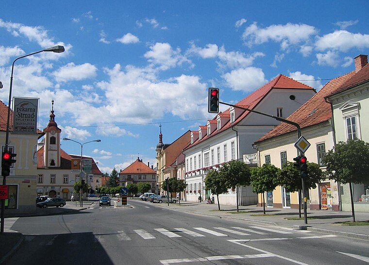
Photo: Žiga, Public domain.
Slovenska Bistrica is a town south of Maribor in eastern Slovenia. It is the seat of the Municipality of Slovenska Bistrica, one of the largest municipalities in Slovenia.
Devina
Village
Devina is a settlement immediately north of Slovenska Bistrica in northeastern Slovenia. The area is part of the traditional region of Styria. It is now included with the rest of the Municipality of Slovenska Bistrica in the Drava Statistical Region.
Spodnja Nova Vas
Village
Spodnja Nova Vas is a village immediately east of Slovenska Bistrica in northeastern Slovenia. The area is part of the traditional region of Styria. It is now included with the rest of the Municipality of Slovenska Bistrica in the Drava Statistical Region.
Sladoledarna čebelica
- Category: food
- Location: Slovenska Bistrica, Slovenia, Central Europe, Europe
- View on OpenStreetMap
Latitude
46.3927° or 46° 23′ 34″ northLongitude
15.57352° or 15° 34′ 25″ eastOpen location code
8FRQ9HVF+3COpenStreetMap ID
node 2780451043OpenStreetMap feature
amenity=ice_creamOpenStreetMap attribute
wheelchair=yes
This page is based on OpenStreetMap, Wikidata, and Wikimedia Commons.
We’d love your help improving our open data sources. Thank you for contributing.
Satellite Map
Discover Sladoledarna čebelica from above in high-definition satellite imagery.
Notable Places Nearby
Highlights include TIC Slovenska Bistrica and Strelski klub SD Impol.
Nearby Places
Explore places such as Pika Pika and Trafika tri dva.
Slovenia: Must-Visit Destinations
Delve into Ljubljana, Maribor, Koper, and Celje.
Curious Ice Cream Parlors to Discover
Uncover intriguing ice cream parlors from every corner of the globe.
About Mapcarta. Data © OpenStreetMap contributors and available under the Open Database License". Text is available under the CC BY-SA 4.0 license, except for photos, directions, and the map. Photo: Jjtkk, CC BY 3.0.