ΑΤΘΙΔΩΝ
ΑΤΘΙΔΩΝ is a bus stop in Athens, Attica. ΑΤΘΙΔΩΝ is situated nearby to the church Αγιος Γεώργιος, as well as near the health club Riaction.| Tap on a place to explore it |
Places of Interest Nearby
Highlights include Parthenon and Kalithea Municipal Stadium ‘Grigoris Labrakis’.
Parthenon

Photo: Elena Tatiana Chis, CC BY-SA 4.0.
The Parthenon is a former temple on the Athenian Acropolis, Greece, that was dedicated to the goddess Athena. Its decorative sculptures are considered some of the high points of classical Greek art, and the Parthenon is considered an enduring symbol of ancient Greece, democracy, and Western civilization. Parthenon is situated 2 km northeast of ΑΤΘΙΔΩΝ.
Kalithea Municipal Stadium ‘Grigoris Labrakis’
Stadium

Photo: Wikijens, CC BY-SA 3.0.
Grigoris Lamprakis Stadium is a public multi-use stadium in Kallithea, Athens, Greece. It is currently used mostly for football matches and is the home stadium of Athens Kallithea FC. The stadium was built in 1970 and currently has a seating capacity of 6,300. Kalithea Municipal Stadium ‘Grigoris Labrakis’ is situated 360 metres northeast of ΑΤΘΙΔΩΝ.
Areopagus
Peak
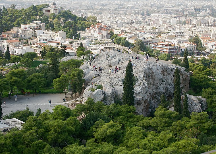
Photo: ajbear, CC BY-SA 2.0.
The Areopagus is a prominent rock outcropping located northwest of the Acropolis in Athens, Greece. Its English name is the Late Latin composite form of the Greek name Areios Pagos, translated "Hill of Ares".
Places in the Area
Nearby places include Kallithea and Koukaki.
Kallithea
Suburb

Photo: Dimorsitanos, CC BY-SA 3.0.
Kallithea is a suburb in Athens agglomeration and a municipality in south Athens regional unit. It is the eighth largest municipality in Greece, as well as the fourth biggest in the Athens urban area.
Koukaki
Neighborhood

Photo: Dimorsitanos, CC BY-SA 3.0.
Koukaki is a southeast neighbourhood of Athens, Greece.
Asýrmatos
Neighborhood
Asyrmatos or Attaliotika is a neighborhood of the center of Athens, Greece. It is located in the west slopes of Philopappos Hill, next to Ano Petralona district.
ΑΤΘΙΔΩΝ
- Type: Bus stop
- Category: transportation
- Location: Athens, Athens Prefecture, Attica, Greece, Balkans, Europe
- View on OpenStreetMap
Latitude
37.95779° or 37° 57′ 28″ northLongitude
23.7125° or 23° 42′ 45″ eastOpen location code
8G95XP57+42OpenStreetMap ID
node 2786681431OpenStreetMap feature
highway=bus_stopOpenStreetMap feature
public_transport=platform
This page is based on OpenStreetMap, Wikidata, and Wikimedia Commons.
We’d love your help improving our open data sources. Thank you for contributing.
Satellite Map
Discover ΑΤΘΙΔΩΝ from above in high-definition satellite imagery.
Notable Places Nearby
Highlights include Αγιος Γεώργιος and Riaction.
Nearby Places
Explore places such as 23 Cafe and Galaktompoureko 10 Me Tono.
Greece: Must-Visit Destinations
Delve into Athens, Thessaloniki, Lesvos, and Arcadia.
Curious Bus Stops to Discover
Uncover intriguing bus stops from every corner of the globe.
About Mapcarta. Data © OpenStreetMap contributors and available under the Open Database License". Text is available under the CC BY-SA 4.0 license, except for photos, directions, and the map. Photo: Ggia, CC BY-SA 3.0.