Hintere Talhauser Matten
Hintere Talhauser Matten is a locality in Ebringen, Breisgau-Hochschwarzwald, Baden-Württemberg. Hintere Talhauser Matten is situated nearby to the locality Storzenhalde, as well as near Kanada.| Tap on a place to explore it |
Places of Interest
Highlights include Berghauser Matten and Jennetal.
Berghauser Matten
Nature reserve

Photo: Thomas Berwing, CC BY-SA 4.0.
Berghauser Matten is a nature reserve.
Jennetal
Nature reserve

Photo: Joergens.mi, CC BY-SA 3.0.
The Jennetal is a valley cut in the Schönberg mountain and also the name of a nature reserve, where it's located.

Places in the Area
Nearby places include Schneeburg and Pfaffenweiler.
Schneeburg
Locality

Photo: Andreas Schwarzkopf, CC BY-SA 3.0.
Schneeburg is a castle ruin between Ebringen and Freiburg, Germany. The ruins are at an altitude of 516 metres on the western summit of Schönberg.
Pfaffenweiler
Village
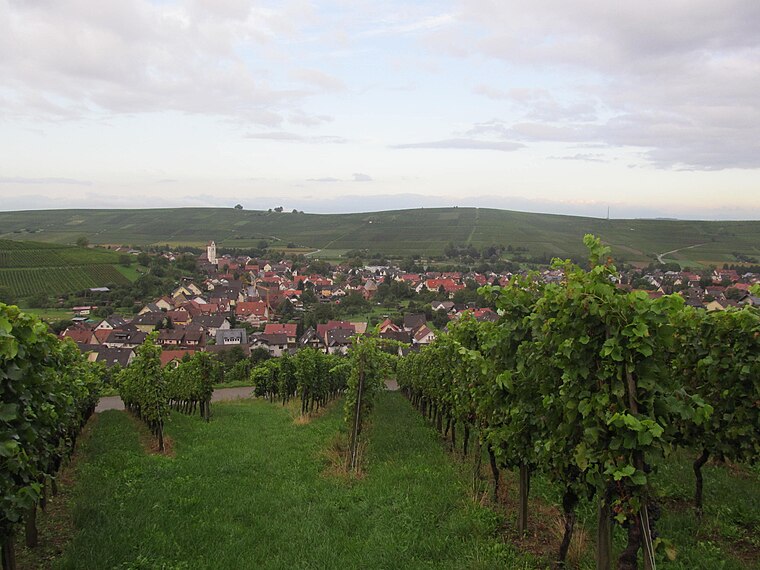
Photo: Gortyna, CC BY-SA 3.0.
Pfaffenweiler is a municipality in the district of Breisgau-Hochschwarzwald in Baden-Württemberg in southern Germany. The landscape here is shaped as much by vineyards as by history.

Hintere Talhauser Matten
Latitude
47.94551° or 47° 56′ 44″ northLongitude
7.78047° or 7° 46′ 50″ eastOpen location code
8FV9WQWJ+65OpenStreetMap ID
node 2803654639OpenStreetMap feature
place=locality
This page is based on OpenStreetMap, Wikidata, and Wikimedia Commons.
We’d love your help improving our open data sources. Thank you for contributing.
Satellite Map
Discover Hintere Talhauser Matten from above in high-definition satellite imagery.
Localities in the Area
Explore places such as Storzenhalde and Kanada.
Notable Places Nearby
Highlights include ehem. Gaisbühlbrünneli and ehemaliger Wasserbehälter Talhausen.
Baden-Württemberg: Must-Visit Destinations
Delve into Stuttgart, Heidelberg, Karlsruhe, and Mannheim.
Curious Localities to Discover
Uncover intriguing localities from every corner of the globe.
About Mapcarta. Data © OpenStreetMap contributors and available under the Open Database License". Text is available under the CC BY-SA 4.0 license, except for photos, directions, and the map. Photo: Traveler100, CC BY-SA 3.0.