Croix de Saint-Felix
Croix de Saint-Felix is a wayside cross in Loiret, Centre-Val de Loire. Croix de Saint-Felix is situated nearby to the pond Evière, as well as near Étang des Trays.| Tap on a place to explore it |
Places in the Area
Nearby places include Ligny-le-Ribault and La Ferté-Saint-Aubin.
Ligny-le-Ribault
Village
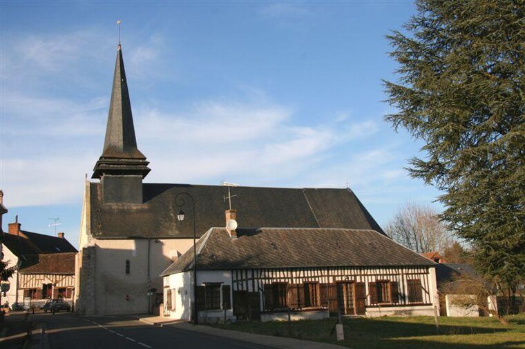
Photo: Vincent4145, CC BY-SA 3.0.
Ligny-le-Ribault is a commune in the Loiret department in north-central France. Ligny-le-Ribault is situated 6 km west of Croix de Saint-Felix.
La Ferté-Saint-Aubin
Village
 La Ferté-Saint-Aubin is a commune in the Loiret department in the administrative region of Centre-Val de Loire, France. La Ferté-Saint-Aubin is situated 6 km east of Croix de Saint-Felix.
Jouy-le-Potier
Village

Photo: Wikimedia, Public domain.
Jouy-le-Potier is a commune in the Loiret department in north-central France. Jouy-le-Potier is situated 7 km northwest of Croix de Saint-Felix.
Croix de Saint-Felix
- Type: Wayside cross
- Category: historic site
- Location: Loiret, Centre-Val de Loire, France, Europe
- View on OpenStreetMap
Latitude
47.6979° or 47° 41′ 53″ northLongitude
1.86412° or 1° 51′ 51″ eastOpen location code
8FV3MVX7+5JOpenStreetMap ID
node 2840387527OpenStreetMap feature
historic=wayside_cross
This page is based on OpenStreetMap, Wikidata, and Wikimedia Commons.
We’d love your help improving our open data sources. Thank you for contributing.
Satellite Map
Discover Croix de Saint-Felix from above in high-definition satellite imagery.
Notable Places Nearby
Highlights include Evière and Étang des Trays.
Nearby Places
Explore places such as Les Trays and Les Brays.
Centre-Val de Loire: Must-Visit Destinations
Delve into Orléans, Tours, Chartres, and Bourges.
Curious Wayside Crosses to Discover
Uncover intriguing wayside crosses from every corner of the globe.
About Mapcarta. Data © OpenStreetMap contributors and available under the Open Database License". Text is available under the CC BY-SA 4.0 license, except for photos, directions, and the map. Photo: PMRMaeyaert, CC BY-SA 3.0.