Steppacher Berg
Steppacher Berg is a peak in Neusäß, Augsburg, Bavaria and has an elevation of 528 metres. Steppacher Berg is situated nearby to the village Deuringen, as well as near the town Stadtbergen.| Tap on a place to explore it |
Places of Interest
Highlights include Augsburg Hospital and Bezirkskrankenhaus Augsburg.
Augsburg Hospital
Hospital

Photo: Wikimedia, CC BY-SA 3.0.
University Hospital Augsburg is with about 1,750 beds one of the largest medical centers in Germany located in Augsburg. It is a teaching hospital of the Universität Augsburg and the only hospital of maximal care in Swabia.
Bezirkskrankenhaus Augsburg
Hospital
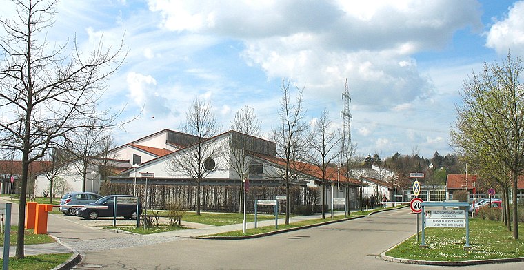
Photo: Wikimedia, CC BY-SA 3.0.
Bezirkskrankenhaus Augsburg is a hospital.

Places in the Area
Nearby places include Augsburg and Neusäß.
Augsburg
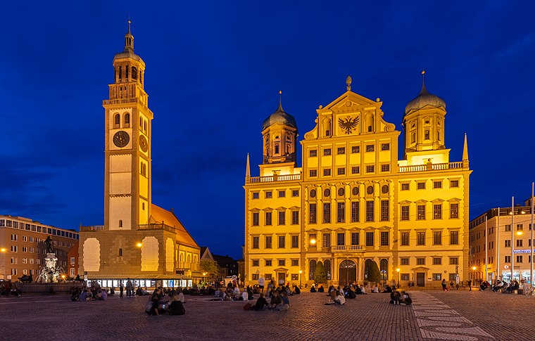
Photo: Wikimedia, CC BY-SA 4.0.
Augsburg is a lovely metropolitan city of 300,000 people and around 885,000 in the urban area in the German Bundesland of Bavaria. Some 60 km northwest of Munich, it is one of the oldest German cities.
Neusäß
Town

Photo: Neitram, CC BY-SA 3.0.
Neusäß, also given in English as Neusaess, is a town in the District of Augsburg, Bavaria, Germany. The town lies on the Schmutter river and borders the city of Augsburg. As of 2018, the city had 22,164 inhabitants.
Stadtbergen
Town
 Stadtbergen is a town in the district of Augsburg, in Bavaria, Germany. It is situated in the outskirts of Augsburg, 4 kilometres west of Augsburg city centre. Stadtbergen was granted town privileges in May 2007.
Steppacher Berg
- Type: Peak with an elevation of 528 metres
- Category: landform
- Location: Neusäß, Augsburg, Bavarian Swabia, Bavaria, Germany, Central Europe, Europe
- View on OpenStreetMap
Latitude
48.3713° or 48° 22′ 17″ northLongitude
10.8273° or 10° 49′ 38″ eastElevation
528 metres (1,732 feet)Open location code
8FWG9RCG+GWOpenStreetMap ID
node 2867951520OpenStreetMap feature
natural=peak
This page is based on OpenStreetMap, Wikidata, and Wikimedia Commons.
We’d love your help improving our open data sources. Thank you for contributing.
Satellite Map
Discover Steppacher Berg from above in high-definition satellite imagery.
Localities in the Area
Explore places such as Steppach and Deuringen.
Notable Places Nearby
Highlights include Hochbehälter Steppach and Bismarck Tower (Augsburg).
Bavarian Swabia: Must-Visit Destinations
Delve into Augsburg, Memmingen, Kempten, and Füssen.
Curious Peaks to Discover
Uncover intriguing peaks from every corner of the globe.
About Mapcarta. Data © OpenStreetMap contributors and available under the Open Database License". Text is available under the CC BY-SA 4.0 license, except for photos, directions, and the map. Photo: Tilman2007, CC BY-SA 3.0.