Caf2é Tulipe
Caf2é Tulipe is a café in Sousse Governorate, Tunisia. Caf2é Tulipe is situated nearby to the park Jardin Sfeya, as well as near Arab Maghreb Square.| Tap on a place to explore it |
Places of Interest Nearby
Highlights include Faculty of Medicine of Sousse and Sousse Olympic Stadium.
Faculty of Medicine of Sousse
University
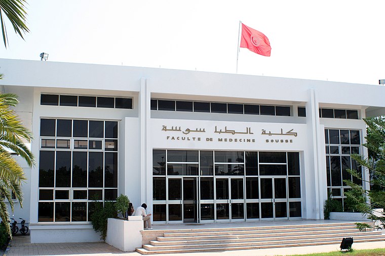
Photo: Wikimedia, CC BY-SA 4.0.
The Faculty of Medicine of Sousse or FMS, is a Tunisian university establishment created according to the law N°74-83 of December 11, 1974. Part of the University of Sousse. Faculty of Medicine of Sousse is situated 1 km south of Caf2é Tulipe.
Sousse Olympic Stadium
Stadium

Photo: Sayada1925, CC BY-SA 4.0.
The Sousse Olympic Stadium is a multi-purpose stadium in Sousse, Tunisia. It is used by the football team Étoile du Sahel, and was used for the 2004 African Cup of Nations. Sousse Olympic Stadium is situated 2 km southwest of Caf2é Tulipe.
Saint Felix Church
Church

Photo: Wikimedia, CC BY-SA 3.0.
Saint Felix Church is situated 1¼ km southeast of Caf2é Tulipe.
Places in the Area
Nearby places include Sousse and Port El Kantaoui.
Sousse

Photo: Newworldltd, Public domain.
Sousse is one of the older cities in Tunisia, possessing an authentic medina, which has been declared a UNESCO World Heritage Site.
Port El Kantaoui

Photo: Tony Hisgett, CC BY 2.0.
Port El Kantaoui is a tourist complex 10 kilometres north of Sousse city in central Tunisia. It was built in 1979 specifically as a tourist center, around a large artificial harbour that provides mooring with 340 berths for luxury yachts, hosting sporting activities from water skiing to paragliding, and several golf courses.
Caf2é Tulipe
- Type: Café
- Location: Sousse Governorate, Tunisia, North Africa, Africa
- View on OpenStreetMap
Latitude
35.83823° or 35° 50′ 18″ northLongitude
10.62379° or 10° 37′ 26″ eastOpen location code
8F7GRJQF+7GOpenStreetMap ID
node 2880087961OpenStreetMap feature
amenity=cafe
This page is based on OpenStreetMap, Wikidata, and Wikimedia Commons.
We’d love your help improving our open data sources. Thank you for contributing.
Satellite Map
Discover Caf2é Tulipe from above in high-definition satellite imagery.
Notable Places Nearby
Highlights include Jardin Sfeya and Arab Maghreb Square.
Nearby Places
Explore places such as Meet & Eat and Les trois Coupoles.
Tunisia: Must-Visit Destinations
Delve into Tunis, Carthage, Sousse, and Kairouan.
Curious Cafés to Discover
Uncover intriguing cafés from every corner of the globe.
About Mapcarta. Data © OpenStreetMap contributors and available under the Open Database License". Text is available under the CC BY-SA 4.0 license, except for photos, directions, and the map. Photo: Wikimedia, CC0.