vlg. Martine
vlg. Martine is a wayside cross in Klagenfurt, Carinthia. vlg. Martine is situated nearby to the pitch Waldarena, as well as near the pond Kuchling-Teich.| Tap on a place to explore it |
Places of Interest Nearby
Highlights include Schloss Seltenheim and Pfarrkirche hl. Johann Baptist, Tultschnig.
Schloss Seltenheim
Castle
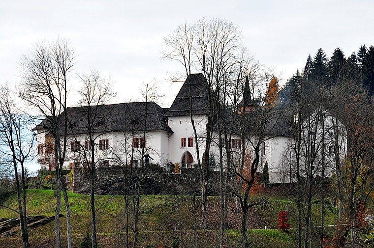
Photo: Johann Jaritz, CC BY-SA 3.0.
Schloss Seltenheim is a castle, which is situated 1 km south of vlg. Martine.
Pfarrkirche hl. Johann Baptist, Tultschnig
Church

Photo: Johann Jaritz, CC BY-SA 3.0 at.
Pfarrkirche hl. Johann Baptist, Tultschnig is a church, which is situated 1¼ km south of vlg. Martine.
Pfarrkirche hl. Martin in Ponfeld, Klagenfurt
Church

Photo: Johann Jaritz, CC BY-SA 4.0.
Pfarrkirche hl. Martin in Ponfeld, Klagenfurt is a church, which is situated 1½ km northwest of vlg. Martine.
Places in the Area
Nearby places include Bärndorf and Krumpendorf am Wörthersee.
Bärndorf
Hamlet

Photo: Niki.L, CC BY-SA 4.0.
Bärndorf is a hamlet, which is situated 5 km north of vlg. Martine.
Krumpendorf am Wörthersee
Village

Photo: Wikimedia, Public domain.
Krumpendorf am Wörthersee is a municipality in Klagenfurt-Land District, in Carinthia, Austria. It is situated on the Wörthersee. Krumpendorf am Wörthersee is situated 5 km southwest of vlg. Martine.
Glanegg
Village
Glanegg is a town in the district of Feldkirchen in Carinthia in Austria. Glanegg is situated 6 km northwest of vlg. Martine.
vlg. Martine
- Type: Wayside cross
- Category: historic site
- Location: Klagenfurt, Carinthia, Austria, Central Europe, Europe
- View on OpenStreetMap
Latitude
46.66615° or 46° 39′ 58″ northLongitude
14.24498° or 14° 14′ 42″ eastOpen location code
8FRPM68V+FXOpenStreetMap ID
node 2899495981OpenStreetMap feature
historic=wayside_cross
This page is based on OpenStreetMap, Wikidata, and Wikimedia Commons.
We’d love your help improving our open data sources. Thank you for contributing.
Satellite Map
Discover vlg. Martine from above in high-definition satellite imagery.
Notable Places Nearby
Highlights include Waldarena and Kuchling-Teich.
Nearby Places
Explore places such as Kuchling-Hochsitz and Klagenfurt Wölfnitz Felsenschmiedgasse.
Carinthia: Must-Visit Destinations
Delve into Villach, Wörthersee, Spittal an der Drau, and Friesach.
Curious Wayside Crosses to Discover
Uncover intriguing wayside crosses from every corner of the globe.
About Mapcarta. Data © OpenStreetMap contributors and available under the Open Database License". Text is available under the CC BY-SA 4.0 license, except for photos, directions, and the map. Photo: Johann Jaritz, CC BY-SA 4.0.