Steinblütenfeld
Steinblütenfeld is a work of art in Rednitzhembach, Roth, Bavaria. Steinblütenfeld is situated nearby to the fire station Freiwillige Feuerwehr Rednitzhembach, as well as near the miniature golf course Funtasygolf.| Tap on a place to explore it |
Places of Interest Nearby
Highlights include Metzgerkreuz bei Rednitzhembach and Steinkreuz nördlich von Pfaffenhofen.
Metzgerkreuz bei Rednitzhembach
Stone
 Metzgerkreuz bei Rednitzhembach is a stone, which is situated 1¼ km east of Steinblütenfeld.
Steinkreuz nördlich von Pfaffenhofen
Stone

Photo: Derzno, CC BY-SA 4.0.
Steinkreuz nördlich von Pfaffenhofen is a stone, which is situated 2 km southeast of Steinblütenfeld.
Schwabach
Railway station
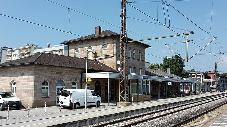
Photo: Dealerofsalvation, CC BY-SA 4.0.
Schwabach station is a railway station in the municipality of Schwabach, located in Middle Franconia, Germany. The station is on the Nuremberg–Augsburg and Nuremberg–Roth lines of Deutsche Bahn. Schwabach is situated 4 km northwest of Steinblütenfeld.
Places in the Area
Nearby places include Igelsdorf and Ottersdorf.


Pruppach
Village

Photo: F30, CC BY-SA 2.5.
Pruppach is a village, which is situated 3½ km southeast of Steinblütenfeld.
Steinblütenfeld
- Type: Work of art
- Wheelchair access: yes
- Category: tourism
- Location: Rednitzhembach, Roth, Middle Franconia, Franconia, Bavaria, Germany, Central Europe, Europe
- View on OpenStreetMap
Latitude
49.29566° or 49° 17′ 44″ northLongitude
11.06278° or 11° 3′ 46″ eastOpen location code
8FXH73W7+74OpenStreetMap ID
node 2905595763OpenStreetMap feature
tourism=artworkOpenStreetMap attribute
wheelchair=yes
This page is based on OpenStreetMap, Wikidata, and Wikimedia Commons.
We’d love your help improving our open data sources. Thank you for contributing.
Satellite Map
Discover Steinblütenfeld from above in high-definition satellite imagery.
Notable Places Nearby
Highlights include Freiwillige Feuerwehr Rednitzhembach and Funtasygolf.
Nearby Places
Explore places such as Schwebende and Sitzende.
Middle Franconia: Must-Visit Destinations
Delve into Nuremberg, Erlangen, Fürth, and Ansbach.
Curious Work Of Arts to Discover
Uncover intriguing work of arts from every corner of the globe.
About Mapcarta. Data © OpenStreetMap contributors and available under the Open Database License". Text is available under the CC BY-SA 4.0 license, except for photos, directions, and the map. Photo: Berthold Werner, CC0.