Pignet
Pignet is a suburb in Six-Fours-les-Plages, Arrondissement of Toulon, Provence-Alpes-Côte d’Azur. Pignet is situated nearby to the neighborhood Pourqueiron, as well as near the suburb Pourquier.| Tap on a place to explore it |
Places of Interest
Highlights include Collégiale Saint-Pierre de Six-Fours and La Seyne–Six-Fours station.
Collégiale Saint-Pierre de Six-Fours
Church
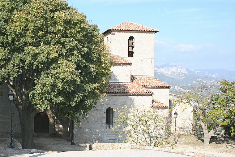
Photo: Rvalette, CC BY-SA 3.0.
Collégiale Saint-Pierre de Six-Fours is a church.
La Seyne–Six-Fours station
Railway station

Photo: Homère plus, CC BY-SA 4.0.
La Seyne–Six-Fours station is a railway station serving the town La Seyne-sur-Mer, Var department, southeastern France. It is situated on the Marseille–Ventimiglia railway. The station is served by regional trains to Marseille and Toulon. –… La Seyne–Six-Fours station is situated 3 km northeast of Pignet.
Église Notre-Dame-du-Bon-Voyage de La Seyne-sur-Mer
Church

Photo: Rvalette, CC BY-SA 3.0.
Église Notre-Dame-du-Bon-Voyage de La Seyne-sur-Mer is a church.
Places in the Area
Nearby places include Six-Fours-les-Plages and La Seyne-sur-Mer.
Six-Fours-les-Plages
Town

Photo: Flobio83, CC BY-SA 3.0.
Six-Fours-les-Plages is a commune in the Var department in the Provence-Alpes-Côte d'Azur region in southeastern France. Inhabitants of Six-Fours-les-Plages refer to themselves as "Six-Fournais".
La Seyne-sur-Mer
Town

Photo: Mfe, CC BY-SA 3.0.
La Seyne-sur-Mer, or simply La Seyne, is a commune in the Var department in the Provence-Alpes-Côte d'Azur region in Southeastern France. La Seyne-sur-Mer, which is part of the agglomeration of Toulon, is situated adjacent to the west of the city.
Sanary-sur-Mer

Photo: Marianne Casamance, CC BY-SA 3.0.
Sanary-sur-Mer, popularly known as Sanary, is a commune in the Var department in the Provence-Alpes-Côte d'Azur region, Southeastern France. Sanary-sur-Mer is located in coastal Provence on the Mediterranean Sea, 13 km west of Toulon and 49 km southeast of Marseille.
Pignet
- Type: Suburb
- Category: locality
- Location: Six-Fours-les-Plages, Arrondissement of Toulon, Var, Provence-Alpes-Côte d’Azur, France, Europe
- View on OpenStreetMap
Latitude
43.09404° or 43° 5′ 39″ northLongitude
5.85566° or 5° 51′ 20″ eastOpen location code
8FM73VV4+J7OpenStreetMap ID
node 290628961OpenStreetMap feature
place=suburb
This page is based on OpenStreetMap, Wikidata, and Wikimedia Commons.
We’d love your help improving our open data sources. Thank you for contributing.
Satellite Map
Discover Pignet from above in high-definition satellite imagery.
In Other Languages
“Pignet” goes by many names.
- Occitan (post 1500): “Pinhet”
Places with the Same Name
Discover other places named “Pignet”.
Localities in the Area
Explore places such as Pourqueiron and Pourquier.
Notable Places Nearby
Highlights include Rond-Point de Zagarolo and La Villa Simone.
Var: Must-Visit Destinations
Delve into Toulon, Saint-Tropez, Hyères, and Fréjus.
Curious Suburbs to Discover
Uncover intriguing suburbs from every corner of the globe.
About Mapcarta. Data © OpenStreetMap contributors and available under the Open Database License". Text is available under the CC BY-SA 4.0 license, except for photos, directions, and the map. Photo: Tobi 87, CC BY-SA 3.0.