Halomsírok
Halomsírok is an archaeological site in Hannersdorf, Oberwart District, Burgenland. Halomsírok is situated nearby to the museum Vasfüggöny Múzeum, as well as near the locality Vas-hegy.| Tap on a place to explore it |
Places of Interest Nearby
Highlights include Hügelgräberfeld Bauernwald I and Hügelgräberfeld Bauernwald II.
Hügelgräberfeld Bauernwald I
Archaeological site

Photo: Steindy, CC BY-SA 4.0.
Hügelgräberfeld Bauernwald I is an archaeological site, which is situated 1½ km northeast of Halomsírok.
Hügelgräberfeld Bauernwald II
Archaeological site
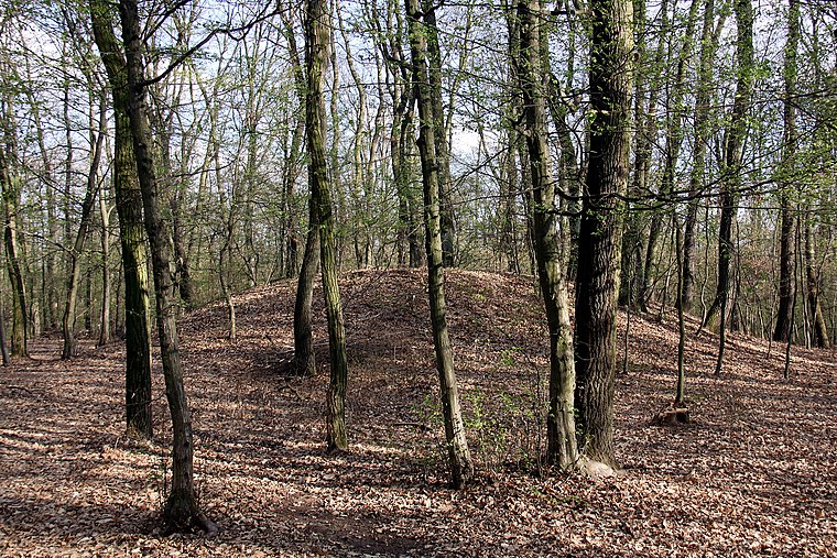
Photo: Steindy, CC BY-SA 4.0.
Hügelgräberfeld Bauernwald II is an archaeological site, which is situated 1½ km north of Halomsírok.
Szent Miklós-templom
Church

Photo: Civertan, CC BY-SA 4.0.
Szent Miklós-templom is a church, which is situated 2 km southeast of Halomsírok.
Places in the Area
Nearby places include Vas-hegy and Burg.


Vaskeresztes
Village

Photo: Darinko, Public domain.
Vaskeresztes is a village in Vas County, Hungary.
Halomsírok
- Type: Archaeological site
- Categories: historic site, tourist attraction, and tourism
- Location: Hannersdorf, Oberwart District, Burgenland, Austria, Central Europe, Europe
- View on OpenStreetMap
Latitude
47.20135° or 47° 12′ 5″ northLongitude
16.42373° or 16° 25′ 25″ eastOpen location code
8FVR6C2F+GFOpenStreetMap ID
node 2906411838OpenStreetMap feature
historic=archaeological_site
This page is based on OpenStreetMap, Wikidata, and Wikimedia Commons.
We’d love your help improving our open data sources. Thank you for contributing.
Satellite Map
Discover Halomsírok from above in high-definition satellite imagery.
Places with the Same Name
Discover other places named “Halomsírok”.
Notable Places Nearby
Highlights include Vasfüggöny Múzeum and Eisenberg.
Nearby Places
Explore places such as Nagyvilágos (mérőtorony) and Geodéziai mérőtorony.
Burgenland: Must-Visit Destinations
Delve into Eisenstadt, Neusiedl am See, Rust, and Güssing.
Curious Archaeological Sites to Discover
Uncover intriguing archaeological sites from every corner of the globe.
About Mapcarta. Data © OpenStreetMap contributors and available under the Open Database License". Text is available under the CC BY-SA 4.0 license, except for photos, directions, and the map. Photo: Wikimedia, CC BY-SA 4.0.