Lohrmanns
Lohrmanns is a brewery in Dresden, Saxon Elbland, Saxony which is located on Freiberger Straße. Lohrmanns is situated nearby to the health club FitX, as well as near the government office Amt für Wirtschaftsförderung.| Tap on a place to explore it |
- Email: info@lohrmannsbrew.de
- Type: Brewery
- Address: Freiberger Straße 37, Dresden, 01067
Places of Interest Nearby
Highlights include Comödie Dresden and Zwinger.
Comödie Dresden
Theater building

Photo: Kolossos, CC BY-SA 3.0.
Comödie Dresden is a theater building.
Zwinger
Park

Photo: Immanuel Giel, CC BY-SA 3.0.
The Zwinger is a palatial complex with gardens in Dresden, Germany. Designed by architect Matthäus Daniel Pöppelmann, it is one of the most important buildings of the Baroque period in Germany. Zwinger is situated 1 km northeast of Lohrmanns.
Semperoper
Theater building
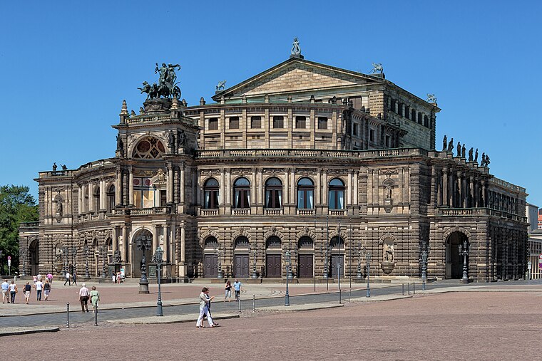
Photo: Avda, CC BY-SA 3.0.
The Semperoper is the opera house of the Sächsische Staatsoper Dresden and the concert hall of the Staatskapelle Dresden. It is also home to the Semperoper Ballett. Semperoper is situated 1 km northeast of Lohrmanns.
Places in the Area
Nearby places include Wilsdruffer Vorstadt and Innere Altstadt.


Friedrichstadt
Suburb

Photo: X-Weinzar, CC BY-SA 3.0.
Friedrichstadt is a neighborhood in central Dresden, Germany. A factory district in the late 19th and early 20th centuries, it is known as the home of the founders of the artistic association known as Die Brücke. Its population is 9,887.
Lohrmanns
- Categories: workshop and industry
- Location: Dresden, Saxon Elbland, Saxony, Germany, Central Europe, Europe
- View on OpenStreetMap
Latitude
51.04914° or 51° 2′ 57″ northLongitude
13.7217° or 13° 43′ 18″ eastOperator
TU Dresden Brauerei GmbHOpen location code
9F3M2PXC+MMOpenStreetMap ID
node 292036311OpenStreetMap feature
craft=brewery
This page is based on OpenStreetMap, Wikidata, and Wikimedia Commons.
We’d love your help improving our open data sources. Thank you for contributing.
Satellite Map
Discover Lohrmanns from above in high-definition satellite imagery.
Places with the Same Name
Discover other places named “Lohrmanns”.
Notable Places Nearby
Highlights include FitX and Dresden International University.
Nearby Places
Explore places such as Bärenhecke and Netto.
Saxon Elbland: Must-Visit Destinations
Delve into Meißen, Riesa, Radebeul, and Freital.
Curious Breweries to Discover
Uncover intriguing breweries from every corner of the globe.
About Mapcarta. Data © OpenStreetMap contributors and available under the Open Database License". Text is available under the CC BY-SA 4.0 license, except for photos, directions, and the map. Photo: Kreidefossil, CC BY-SA 3.0.