Bastrup - primitiv teltsplads
Bastrup - primitiv teltsplads is a campsite in Kolding Municipality, Region of Southern Denmark. Bastrup - primitiv teltsplads is situated nearby to the forest Margrethelund, as well as near Bastrup Skov.| Tap on a place to explore it |
Places of Interest Nearby
Highlights include Vamdrup Station and Kongeåmuseet.
Vamdrup Station
Railway station

Photo: Hjart, CC BY-SA 4.0.
Vamdrup Station is a railway station, which is situated 2½ km northeast of Bastrup - primitiv teltsplads.
Kongeåmuseet
Museum
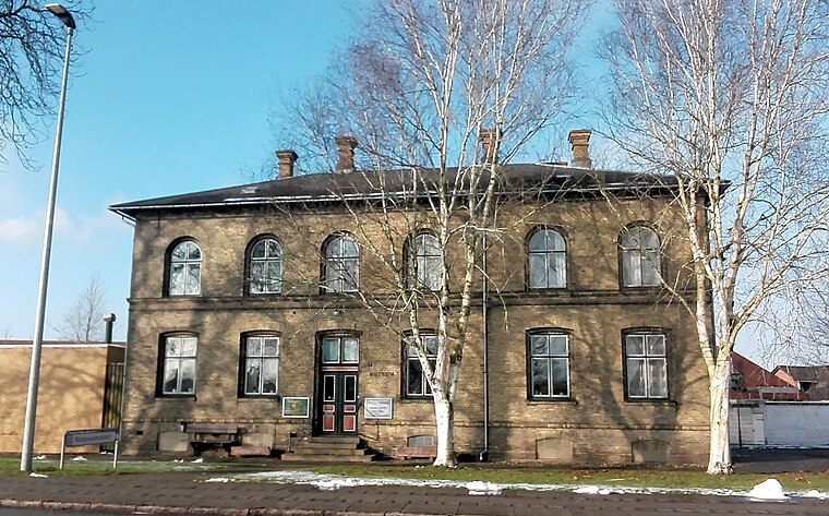
Photo: Beethoven9, CC BY-SA 4.0.
Kongeåmuseet is a museum, which is situated 2½ km northeast of Bastrup - primitiv teltsplads.
Vamdrup Church
Church

Photo: Hjart, CC BY-SA 4.0.
Vamdrup Church is situated 2 km north of Bastrup - primitiv teltsplads.
Places in the Area
Nearby places include Vamdrup and Skodborg.
Vamdrup
Village

Photo: Hjart, CC BY-SA 4.0.
Vamdrup is a railway town in the Region of Southern Denmark, near Kolding in Denmark with a population of 4,940. Vamdrup is served by Vamdrup station on the Fredericia–Padborg railway line. Vamdrup is situated 2½ km northeast of Bastrup - primitiv teltsplads.
Skodborg
Village

Photo: Hjart, CC BY-SA 4.0.
Skodborg is a small town, with a population of 1,221, in Vejen Municipality, Region of Southern Denmark in Denmark. Skodborg is located 29 km southwest of Kolding, 35 km northwest of Haderslev, 10 km northeast of Rødding and 9 km south of Vejen. Skodborg is situated 7 km west of Bastrup - primitiv teltsplads.
Jels
Village

Photo: Hjart, CC BY-SA 4.0.
Jels is a town, with a population of 1,962, situated 17 km northwest of Vojens, 26 km southwest of Kolding, 30 km east of Ribe and 17 km south of Vejen. Jels is situated 7 km southwest of Bastrup - primitiv teltsplads.
Bastrup - primitiv teltsplads
- Type: Campsite
- Categories: tourism and camping
- Location: Kolding Municipality, Region of Southern Denmark, Denmark, Nordic countries, Europe
- View on OpenStreetMap
Latitude
55.41178° or 55° 24′ 42″ northLongitude
9.26298° or 9° 15′ 47″ eastOpen location code
9F7FC767+P5OpenStreetMap ID
node 2923177220OpenStreetMap feature
tourism=camp_site
This page is based on OpenStreetMap, Wikidata, and Wikimedia Commons.
We’d love your help improving our open data sources. Thank you for contributing.
Satellite Map
Discover Bastrup - primitiv teltsplads from above in high-definition satellite imagery.
Notable Places Nearby
Highlights include Bastrup Bro and Helges Høj.
Nearby Places
Explore places such as Bindtoftegård and Gl Skole.
Denmark: Must-Visit Destinations
Delve into Copenhagen, Aarhus, Odense, and Aalborg.
Curious Campsites to Discover
Uncover intriguing campsites from every corner of the globe.
About Mapcarta. Data © OpenStreetMap contributors and available under the Open Database License". Text is available under the CC BY-SA 4.0 license, except for photos, directions, and the map. Photo: Wikimedia, CC BY-SA 3.0.