Association des Maires de l’Isère
Association des Maires de l’Isère is a government office in Grenoble, Isère, Auvergne-Rhône-Alpes. Association des Maires de l’Isère is situated nearby to the square Place Pasteur, as well as near the health club Auro-Myra.| Tap on a place to explore it |
Places of Interest Nearby
Highlights include Bibliothèque municipale de Grenoble and Perret tower.
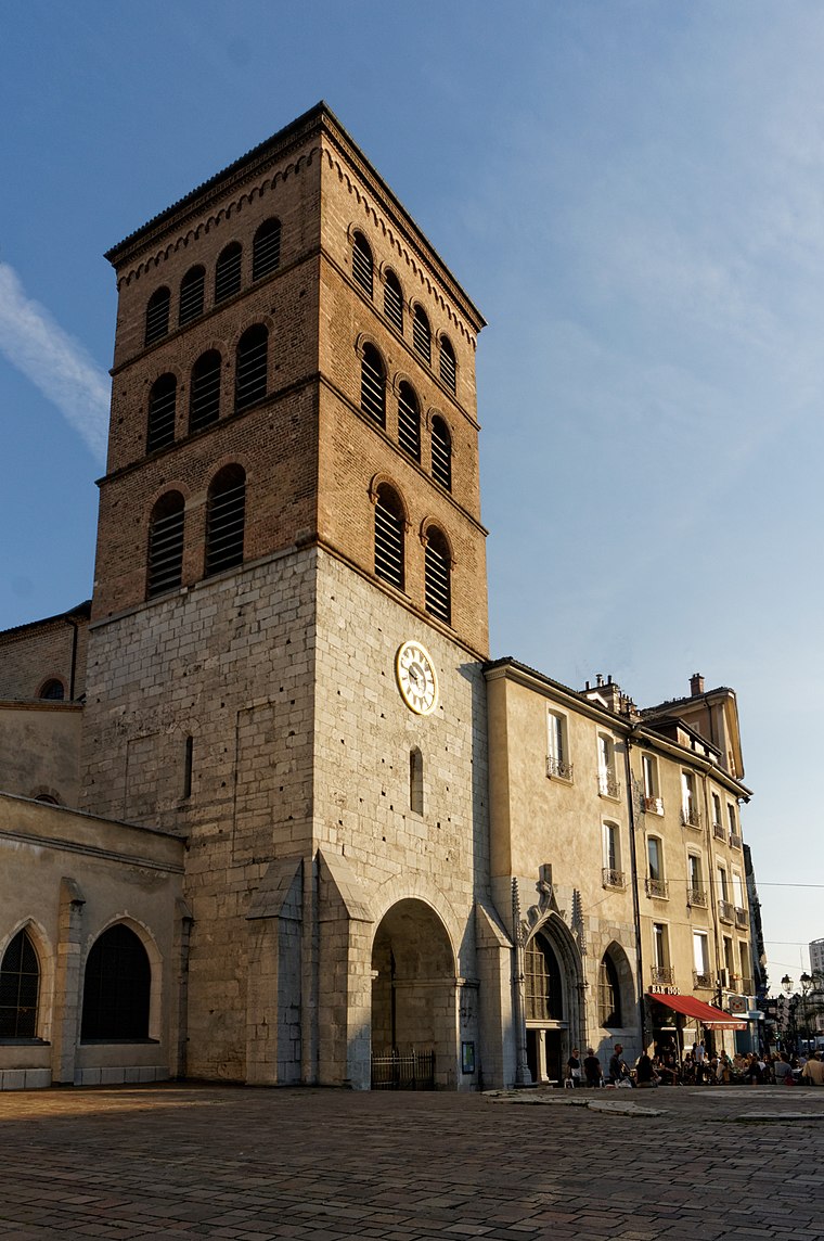
Bibliothèque municipale de Grenoble
Library

Photo: Rémih, CC BY-SA 3.0.
The Bibliothèque municipale de Grenoble is a library in Grenoble, France. It was founded in 1772, following the succession of Bishop, Jean de Caulet. The current building located Boulevard Maréchal Lyautey was opened in January 1960 for the University and since 1970, for all audiences. Bibliothèque municipale de Grenoble is situated 210 metres northwest of Association des Maires de l’Isère.
Perret tower

Photo: Wikimedia, Public domain.
The Perret tower, originally called La tour pour regarder les montagnes, is an observation tower located in Grenoble, in the Paul Mistral public park. It is the first tower built in reinforced concrete in Europe. Perret tower is situated 280 metres northeast of Association des Maires de l’Isère.
Grenoble Graduate School of Business
College
 Grenoble Ecole de Management is a French graduate business school or Grande Ecole, founded in 1984 in Grenoble, in the Auvergne-Rhone Alpes region by the Chamber of Commerce and Industry of Grenoble. Grenoble Graduate School of Business is situated 1½ km northwest of Association des Maires de l’Isère.
Places in the Area
Nearby places include Notre-Dame and Saint-Martin-d’Hères.
Saint-Martin-d’Hères
Town

Photo: Binnette, CC BY-SA 3.0.
Saint-Martin-d'Hères is a commune in the Isère department in southeastern France. Part of the Grenoble urban unit, it is the largest suburb of the city of Grenoble and is adjacent to it on the east.
University campus in Grenoble
Suburb

Photo: Rémih, CC BY-SA 3.0.
University campus in Grenoble is a suburb, which is situated 3 km east of Association des Maires de l’Isère.
Association des Maires de l’Isère
- Type: Government office
- Also known as: “AMI”
- Categories: office and government building
- Location: Grenoble, Arrondissement of Grenoble, Isère, Auvergne-Rhône-Alpes, France, Europe
- View on OpenStreetMap
Latitude
45.18376° or 45° 11′ 2″ northLongitude
5.73234° or 5° 43′ 56″ eastOpen location code
8FQ75PMJ+GWOpenStreetMap ID
node 2923350058OpenStreetMap feature
office=government
This page is based on OpenStreetMap, Wikidata, and Wikimedia Commons.
We’d love your help improving our open data sources. Thank you for contributing.
Satellite Map
Discover Association des Maires de l’Isère from above in high-definition satellite imagery.
Notable Places Nearby
Highlights include Place Pasteur and Auro-Myra.
Nearby Places
Explore places such as Institut Lionel Paul and Bd Marechal Joffre-park hotel.
Isère: Must-Visit Destinations
Delve into Vienne, Voiron, Alpe d’Huez, and Les Deux Alpes.
Curious Government Offices to Discover
Uncover intriguing government offices from every corner of the globe.
About Mapcarta. Data © OpenStreetMap contributors and available under the Open Database License". Text is available under the CC BY-SA 4.0 license, except for photos, directions, and the map. Photo: Inkey, CC BY 2.5.