Hirschgraben-Hütte
Hirschgraben-Hütte is a shelter in Baden-Württemberg, Germany. Hirschgraben-Hütte is situated nearby to the nature reserve Oberbruchwiesen, as well as near the village Linkenheim-Hochstetten.| Tap on a place to explore it |
Places of Interest Nearby
Highlights include Oberbruchwiesen and Graben-Neudorf station.
Oberbruchwiesen
Nature reserve

Photo: Joachim Lutz, CC BY-SA 4.0.
Oberbruchwiesen is a nature reserve.
Graben-Neudorf station
Railway station

Photo: AF666, CC BY-SA 3.0.
Graben-Neudorf station is the focal point of the town of Graben-Neudorf in the German state of Baden-Württemberg. It is of particular importance for rail transport because it is a railway junction, which is crossed by the Rhine Railway between Mannheim and Karlsruhe, connecting to the Rhine Valley Railway to Basle, and the Bruhrain Railway between Bruchsal and Germersheim. Graben-Neudorf station is situated 4 km northeast of Hirschgraben-Hütte.
Kohlplattenschlag
Nature reserve

Photo: Wikimedia, CC BY-SA 2.0 de.
Kohlplattenschlag is a nature reserve, which is situated 3½ km east of Hirschgraben-Hütte.
Places in the Area
Nearby places include Linkenheim-Hochstetten and Friedrichstal.
Linkenheim-Hochstetten
Village

Photo: Rauenstein, CC BY-SA 3.0.
Linkenheim-Hochstetten is a municipality in the district of Karlsruhe, Baden-Württemberg, Germany. It is situated on the right bank of the Rhine, 17 km north of Karlsruhe. Linkenheim-Hochstetten is situated 3½ km west of Hirschgraben-Hütte.
Friedrichstal
Village
Friedrichstal is a part of Stutensee in the district of Karlsruhe in Baden-Wuerttemberg, Germany. Friedrichstal is situated 4 km southeast of Hirschgraben-Hütte.
Graben-Neudorf
Village
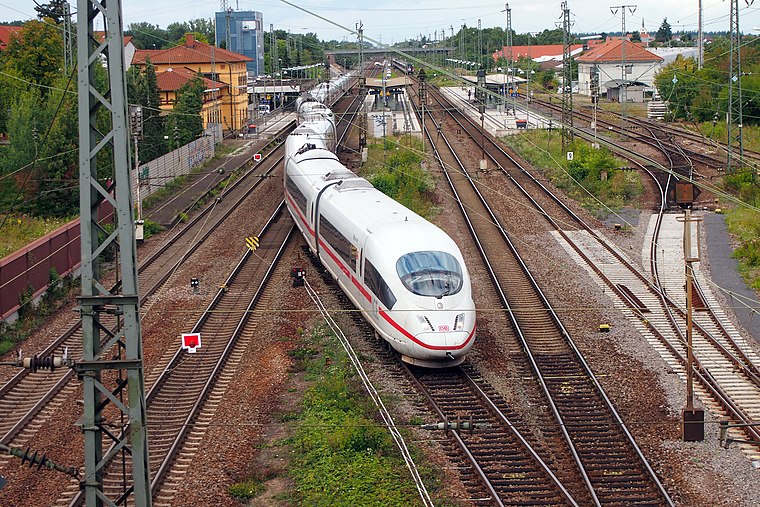
Photo: BlueBreezeWiki, CC BY-SA 3.0.
Graben-Neudorf is a municipality in Northern Karlsruhe district in Baden-Württemberg, Germany. It was created when the two communities of Graben and Neudorf were united on January 1, 1972. Graben-Neudorf is situated 4 km northeast of Hirschgraben-Hütte.
Hirschgraben-Hütte
- Type: Shelter
- Location: Baden-Württemberg, Germany, Central Europe, Europe
- View on OpenStreetMap
Latitude
49.13645° or 49° 8′ 11″ northLongitude
8.45569° or 8° 27′ 21″ eastInception
1912Open location code
8FXC4FP4+H7OpenStreetMap ID
node 292685590OpenStreetMap feature
amenity=shelter
This page is based on OpenStreetMap, Wikidata, and Wikimedia Commons.
We’d love your help improving our open data sources. Thank you for contributing.
Satellite Map
Discover Hirschgraben-Hütte from above in high-definition satellite imagery.
Notable Places Nearby
Highlights include Naturdenkmal Dicke Eiche and FV Hochstetten.
Nearby Places
Explore places such as Galgengraben and Versuchshallen des Instituts für Maschinenwesen im Baubetrieb, KIT (Universität Karlsruhe).
Baden-Württemberg: Must-Visit Destinations
Delve into Stuttgart, Heidelberg, Karlsruhe, and Mannheim.
Curious Shelters to Discover
Uncover intriguing shelters from every corner of the globe.
About Mapcarta. Data © OpenStreetMap contributors and available under the Open Database License". Text is available under the CC BY-SA 4.0 license, except for photos, directions, and the map. Photo: Traveler100, CC BY-SA 3.0.