Hinterberger
Hinterberger is in Metzingen, Reutlingen, Baden-Württemberg. Hinterberger is situated nearby to the peak Weinberg, as well as near Altenheimpark.| Tap on a place to explore it |
Places of Interest Nearby
Highlights include Weinberg and Metzingen station.

Metzingen station
Railway station
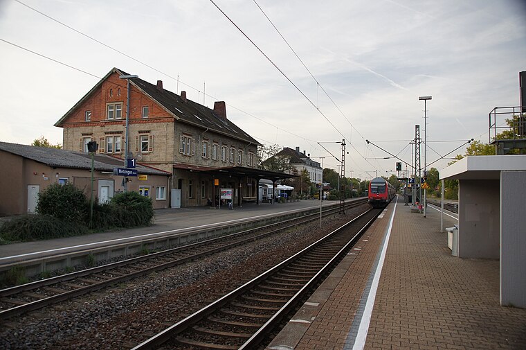
Photo: Baron2105, CC BY-SA 3.0.
Metzingen station is a railway junction in Metzingen in the German state of Baden-Württemberg. It is on the Plochingen–Immendingen railway, where the Erms Valley Railway branches off to Bad Urach. It is served by a pair of InterCity trains and regional trains. Metzingen station is situated 1 km southwest of Hinterberger.
vhs Metzingen-Ermstal
College

Photo: RealMetzor, CC0.
vhs Metzingen-Ermstal is a college, which is situated 1 km southwest of Hinterberger.
Places in the Area
Nearby places include Neuhausen an der Erms and Grafenberg.
Neuhausen an der Erms
Suburb

Photo: Daniel L’Jackson, CC BY-SA 4.0.
Neuhausen an der Erms is a suburb.
Grafenberg
Village

Photo: qwesy qwesy, CC BY 3.0.
Grafenberg is a municipality in the district of Reutlingen in Baden-Württemberg in Germany. Grafenberg is situated 2½ km north of Hinterberger.
Dettingen an der Erms
Village

Photo: DerFussi, CC BY-SA 3.0.
Dettingen an der Erms is a town in the district of Reutlingen in Baden-Württemberg in Germany. The town about twelve kilometers north-east of Reutlingen in Baden-Wuerttemberg or about 46 kilometers from Stuttgart. Dettingen an der Erms is situated 3½ km southeast of Hinterberger.
Hinterberger
- Type: Sign
- Categories: information and tourism
- Location: Metzingen, Reutlingen, Tübingen Region, Baden-Württemberg, Germany, Central Europe, Europe
- View on OpenStreetMap
Latitude
48.54281° or 48° 32′ 34″ northLongitude
9.30054° or 9° 18′ 2″ eastElevation
458 metres (1,503 feet)Operator
Schwäbischer AlbvereinOpen location code
8FWFG8V2+46OpenStreetMap ID
node 2939773922OpenStreetMap feature
tourism=information
This page is based on OpenStreetMap, Wikidata, and Wikimedia Commons.
We’d love your help improving our open data sources. Thank you for contributing.
Satellite Map
Discover Hinterberger from above in high-definition satellite imagery.
Places with the Same Name
Discover other places named “Hinterberger”.
Notable Places Nearby
Highlights include Altenheimpark and Spielplatz im Bühle.
Nearby Places
Explore places such as Parkplatz Hinterberger and Überm Herrlishäusle.
Baden-Württemberg: Must-Visit Destinations
Delve into Stuttgart, Heidelberg, Karlsruhe, and Mannheim.
Curious Places to Discover
Uncover intriguing places from every corner of the globe.
About Mapcarta. Data © OpenStreetMap contributors and available under the Open Database License". Text is available under the CC BY-SA 4.0 license, except for photos, directions, and the map. Photo: Traveler100, CC BY-SA 3.0.