Karoline Meyer
Karoline Meyer is a memorial in Mülheim, Mülheim an der Ruhr, North Rhine-Westphalia. Karoline Meyer is situated nearby to the shopping center Forum, as well as near the sports venue all inclusive Fitness.| Tap on a place to explore it |
Places of Interest Nearby
Highlights include Forum and Mülheim (Ruhr) Hauptbahnhof.

Mülheim (Ruhr) Hauptbahnhof
Railway station
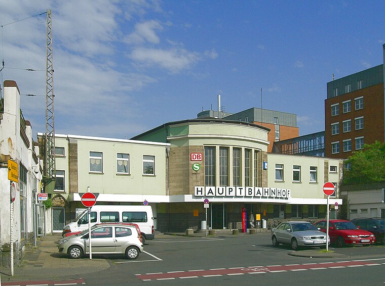
Photo: Docfeelgood3, Public domain.
Mülheim Hauptbahnhof is a railway station for the city of Mülheim in the German state of North Rhine-Westphalia. It was renamed as a Hauptbahnhof in 1974 at the time of the rebuilding of the Dortmund–Duisburg line as part of the establishment of the Rhine-Ruhr S-Bahn. Mülheim (Ruhr) Hauptbahnhof is situated 250 metres north of Karoline Meyer.
Kunstmuseum Mülheim an der Ruhr
Museum

Photo: Wikimedia, CC BY-SA 3.0 de.
Kunstmuseum Mülheim an der Ruhr is situated 310 metres west of Karoline Meyer.
Places in the Area
Nearby places include Siedlung Mausegatt and Styrum.
Siedlung Mausegatt
Neighborhood

Photo: Mdarge, CC BY-SA 3.0.
Siedlung Mausegatt is a neighborhood, which is situated 2½ km east of Karoline Meyer.
Styrum
Suburb

Photo: Docfeelgood3, Public domain.
Styrum is a suburb, which is situated 3 km northwest of Karoline Meyer.
Alstaden
Suburb

Photo: Macchiavelli2, CC BY-SA 4.0.
Alstaden is a suburb, which is situated 5 km northwest of Karoline Meyer.
Karoline Meyer
- Type: Memorial
- Category: historic site
- Location: Mülheim, Mülheim an der Ruhr, Düsseldorf, Ruhr, North Rhine-Westphalia, Germany, Central Europe, Europe
- View on OpenStreetMap
Latitude
51.42911° or 51° 25′ 45″ northLongitude
6.88697° or 6° 53′ 13″ eastNetwork
Stolpersteine Mülheim an der RuhrOpen location code
9F38CVHP+JQOpenStreetMap ID
node 2966011737OpenStreetMap feature
historic=memorial
This page is based on OpenStreetMap, Wikidata, and Wikimedia Commons.
We’d love your help improving our open data sources. Thank you for contributing.
Satellite Map
Discover Karoline Meyer from above in high-definition satellite imagery.
Places with the Same Name
Discover other places named “Karoline Meyer”.
Notable Places Nearby
Highlights include all inclusive Fitness and Technisches Rathaus.
Nearby Places
Explore places such as Josef Meyer and Abraham Meyer.
Ruhr: Must-Visit Destinations
Delve into Dortmund, Essen, Duisburg, and Gelsenkirchen.
Curious Memorials to Discover
Uncover intriguing memorials from every corner of the globe.
About Mapcarta. Data © OpenStreetMap contributors and available under the Open Database License". Text is available under the CC BY-SA 4.0 license, except for photos, directions, and the map. Photo: Omi´s Törtchen, CC BY-SA 2.0 de.