Lermoos, Camping Hofherr
Lermoos, Camping Hofherr is a bus stop in Lermoos, Reutte District, Tyrol. Lermoos, Camping Hofherr is situated nearby to the church Mooskerkerkapelle, as well as near Hl.Kathrina.| Tap on a place to explore it |
Places of Interest Nearby
Highlights include Hotel Post and Lermoos railway station.
Hotel Post
Hotel

Photo: Ricardalovesmonuments, CC BY 4.0.
Hotel Post is situated 450 metres south of Lermoos, Camping Hofherr.
Lermoos railway station
Railway station
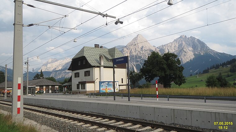
Photo: David Short, CC BY 2.0.
Lermoos railway station is situated 1 km northwest of Lermoos, Camping Hofherr.
Lermoos, Ansitz Felsenheim
Chalet

Photo: Kulmalukko, CC BY-SA 4.0.
Lermoos, Ansitz Felsenheim is a chalet, which is situated 630 metres south of Lermoos, Camping Hofherr.
Places in the Area
Nearby places include Ehrwald and Lähn.
Ehrwald

Photo: Triplec85, CC BY-SA 3.0.
Ehrwald is a picturesque village in the Northwest Tyrol region of Austria. Nestled at the foot of the Zugspitze, Germany's highest peak, Ehrwald is a popular destination for outdoor enthusiasts year-round.
Lähn
Hamlet

Photo: Wikimedia, CC BY-SA 3.0.
Lähn is a hamlet, which is situated 4½ km northwest of Lermoos, Camping Hofherr.
Gartnerwand
Locality

Photo: Sven Schefzyk, CC BY-SA 3.0.
Gartnerwand is a locality, which is situated 5 km west of Lermoos, Camping Hofherr.
Lermoos, Camping Hofherr
- Type: Bus stop
- Categories: transport stop and transportation
- Location: Lermoos, Reutte District, Tyrol, Austria, Central Europe, Europe
- View on OpenStreetMap
Latitude
47.40203° or 47° 24′ 7″ northLongitude
10.88892° or 10° 53′ 20″ eastOpen location code
8FVGCV2Q+RHOpenStreetMap ID
node 29923897OpenStreetMap feature
public_transport=stop_position
This page is based on OpenStreetMap, Wikidata, and Wikimedia Commons.
We’d love your help improving our open data sources. Thank you for contributing.
Satellite Map
Discover Lermoos, Camping Hofherr from above in high-definition satellite imagery.
Notable Places Nearby
Highlights include Mooskerkerkapelle and Hl.Kathrina.
Nearby Places
Explore places such as Camping Hofherr and Baguette.
Tyrol: Must-Visit Destinations
Delve into Innsbruck, Kufstein, Lienz, and Kitzbühel.
Curious Bus Stops to Discover
Uncover intriguing bus stops from every corner of the globe.
About Mapcarta. Data © OpenStreetMap contributors and available under the Open Database License". Text is available under the CC BY-SA 4.0 license, except for photos, directions, and the map. Photo: Traveler100, CC BY-SA 3.0.