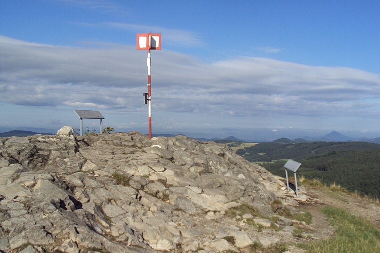
Sokolčík
Sokolčík is a peak in Svor, Česká Lípa District, Liberec Region and has an elevation of 502 metres. Sokolčík is situated nearby to the village Svor, as well as near the locality Pod Klíčem.| Tap on a place to explore it |
Places of Interest
Highlights include Klič and Svor.


Places in the Area
Nearby places include Nový Bor and Cvikov.
Nový Bor
Town

Photo: Wikimedia, CC BY-SA 3.0.
Nový Bor is a town in Česká Lípa District in the Liberec Region of the Czech Republic. It has about 11,000 inhabitants. The town is known for its glass industry. The historic town centre is well preserved and is protected as an urban monument zone.
Cvikov
Town

Photo: VitVit, CC BY-SA 4.0.
Cvikov is a town in Česká Lípa District in the Liberec Region of the Czech Republic. It has about 4,500 inhabitants.
Svor
Village

Photo: Wikimedia, CC BY-SA 3.0.
Svor is a municipality and village in Česká Lípa District in the Liberec Region of the Czech Republic. It has about 700 inhabitants.
Sokolčík
- Type: Peak with an elevation of 502 metres
- Also known as: “Sokolík”
- Category: landform
- Location: Svor, Česká Lípa District, Liberec Region, Czech Republic, Central Europe, Europe
- View on OpenStreetMap
Latitude
50.7896° or 50° 47′ 23″ northLongitude
14.59° or 14° 35′ 24″ eastElevation
502 metres (1,647 feet)Open location code
9F2PQHQR+V2OpenStreetMap ID
node 3010241546OpenStreetMap feature
natural=peak
This page is based on OpenStreetMap, Wikidata, and Wikimedia Commons.
We’d love your help improving our open data sources. Thank you for contributing.
Satellite Map
Discover Sokolčík from above in high-definition satellite imagery.
In Other Languages
“Sokolčík” goes by many names.
- German: “Falkenberg”
Localities in the Area
Explore places such as Pod Klíčem and Rousínov.
Notable Places Nearby
Highlights include Holy Trinity Chapel and Obecní úřad Svor.
Czech Republic: Must-Visit Destinations
Delve into Prague, Brno, Pilsen, and Ostrava.
Curious Peaks to Discover
Uncover intriguing peaks from every corner of the globe.
About Mapcarta. Data © OpenStreetMap contributors and available under the Open Database License". Text is available under the CC BY-SA 4.0 license, except for photos, directions, and the map. Photo: john mcsporran, CC BY 2.0.