Birkenstichhütte
Birkenstichhütte is a picnic site in Baden-Württemberg, Germany. Birkenstichhütte is situated nearby to the nature reserve Ölberg Ehrenstetten, as well as near the town Staufen im Breisgau.| Tap on a place to explore it |
Places of Interest Nearby
Highlights include St. Georgskirche and Ölberg Ehrenstetten.
St. Georgskirche
Church

Photo: Joergens.mi, CC BY-SA 3.0.
St. Georgskirche is a church, which is situated 1½ km north of Birkenstichhütte.
Ölberg Ehrenstetten
Nature reserve

Photo: Andreas Schwarzkopf, CC BY-SA 3.0.
Ölberg Ehrenstetten is a nature reserve.
Magdalenenkapelle
Church

Photo: Joergens.mi, CC BY-SA 3.0.
Magdalenenkapelle is a church, which is situated 2 km southwest of Birkenstichhütte.
Places in the Area
Nearby places include Staufen im Breisgau and Bollschweil.
Staufen im Breisgau
Town

Photo: Michael Sch., CC BY-SA 3.0.
Staufen im Breisgau is a German town in the Breisgau-Hochschwarzwald district of Baden-Württemberg. It had a population of approximately 8,300 in 2019.
Bollschweil
Village

Photo: BrianKohn, CC BY-SA 3.0.
Bollschweil is a municipality in the Breisgau-Hochschwarzwald district, Baden-Württemberg, Germany, located approximately 10 km south of Freiburg. Bollschweil is situated 3½ km northeast of Birkenstichhütte.
Pfaffenweiler
Village
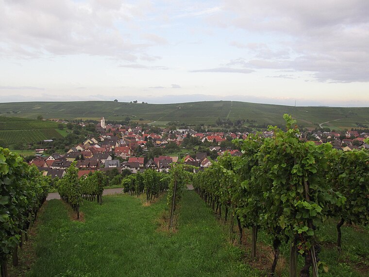
Photo: Gortyna, CC BY-SA 3.0.
Pfaffenweiler is a municipality in the district of Breisgau-Hochschwarzwald in Baden-Württemberg in southern Germany. The landscape here is shaped as much by vineyards as by history. Pfaffenweiler is situated 4 km north of Birkenstichhütte.
Birkenstichhütte
- Type: Picnic site
- Categories: tourism and shelter
- Location: Baden-Württemberg, Germany, Central Europe, Europe
- View on OpenStreetMap
Latitude
47.90079° or 47° 54′ 3″ northLongitude
7.75142° or 7° 45′ 5″ eastOpen location code
8FV9WQ22+8HOpenStreetMap ID
node 302368736OpenStreetMap feature
amenity=shelterOpenStreetMap feature
tourism=picnic_site
This page is based on OpenStreetMap, Wikidata, and Wikimedia Commons.
We’d love your help improving our open data sources. Thank you for contributing.
Satellite Map
Discover Birkenstichhütte from above in high-definition satellite imagery.
Notable Places Nearby
Highlights include Kleinfeld and Sonnenhof.
Nearby Places
Explore places such as Waldparkplatz and Hackschnitzelaufbereitung.
Baden-Württemberg: Must-Visit Destinations
Delve into Stuttgart, Heidelberg, Karlsruhe, and Mannheim.
Curious Picnic Sites to Discover
Uncover intriguing picnic sites from every corner of the globe.
About Mapcarta. Data © OpenStreetMap contributors and available under the Open Database License". Text is available under the CC BY-SA 4.0 license, except for photos, directions, and the map. Photo: Traveler100, CC BY-SA 3.0.