Fürst Karl
Fürst Karl is a memorial in Sigmaringen, Tübingen Region, Baden-Württemberg. Fürst Karl is situated nearby to the square Karlsplatz, as well as near the shopping center Marstall-Passage.| Tap on a place to explore it |
Places of Interest Nearby
Highlights include Sigmaringen Castle and Rathaus Sigmaringen.
Sigmaringen Castle
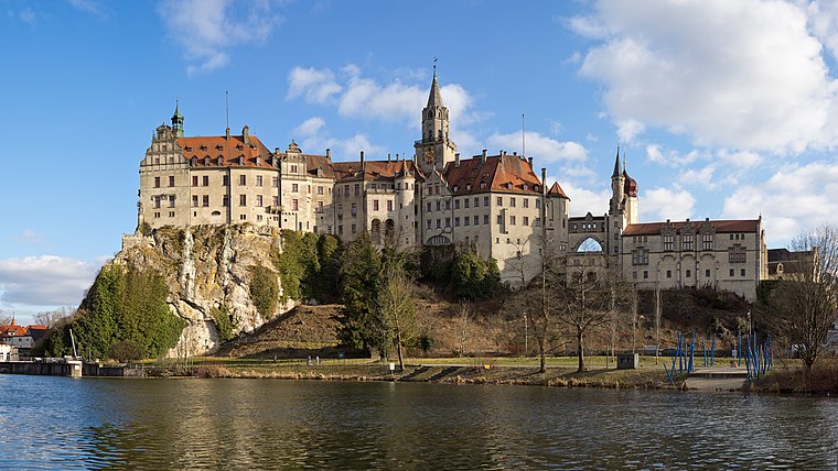
Photo: Milseburg, CC BY-SA 4.0.
Sigmaringen Castle was the princely castle and seat of government for the Princes of Hohenzollern-Sigmaringen. Situated in the Swabian Alb region of Baden-Württemberg, Germany, this castle dominates the skyline of the town of Sigmaringen. Sigmaringen Castle is situated 120 metres west of Fürst Karl.
Rathaus Sigmaringen
Town hall

Photo: LepoRello, CC BY-SA 3.0.
Rathaus Sigmaringen is a town hall, which is situated 120 metres southwest of Fürst Karl.
Stadtpfarrkirche St. Johann (Sigmaringen)
Church

Photo: Louis Bafrance, CC BY-SA 3.0.
Stadtpfarrkirche St. Johann (Sigmaringen) is a church, which is situated 170 metres west of Fürst Karl.
Places in the Area
Nearby places include Inzigkofen and Sigmaringendorf.
Inzigkofen
Village

Photo: Simisa, CC BY-SA 3.0.
Inzigkofen is a municipality in the district of Sigmaringen in Baden-Württemberg in Germany. Historically, it is part of the Swabian north Alpine foreland basin. Inzigkofen is situated 3½ km southwest of Fürst Karl.
Sigmaringendorf
Village
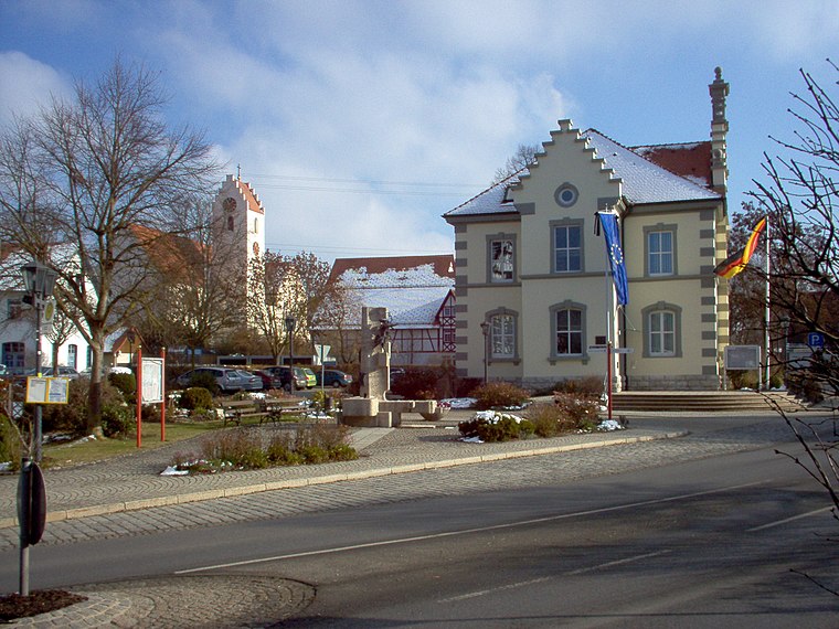
Photo: Louis Bafrance, CC BY-SA 3.0.
Sigmaringendorf is a small town in the district of Sigmaringen in Baden-Württemberg in Germany. In Sigmaringendorf the small river Lauchert flows into the Danube. There is an open-air-theatre in Sigmaringendorf, it's called Waldbühne Sigmaringendorf. Sigmaringendorf is situated 4 km southeast of Fürst Karl.
Bingen
Village
Bingen is a municipality in the district of Sigmaringen in Baden-Württemberg in Germany. Bingen is situated 5 km northeast of Fürst Karl.
Fürst Karl
- Type: Memorial
- Wheelchair access: yes
- Category: historic site
- Location: Sigmaringen, Sigmaringen, Tübingen Region, Bodensee Region, Baden-Württemberg, Germany, Central Europe, Europe
- View on OpenStreetMap
Latitude
48.08771° or 48° 5′ 16″ northLongitude
9.21809° or 9° 13′ 5″ eastInception
1869Open location code
8FWF36Q9+36OpenStreetMap ID
node 3035849417OpenStreetMap feature
historic=memorialOpenStreetMap attribute
wheelchair=yes
This page is based on OpenStreetMap, Wikidata, and Wikimedia Commons.
We’d love your help improving our open data sources. Thank you for contributing.
Satellite Map
Discover Fürst Karl from above in high-definition satellite imagery.
Notable Places Nearby
Highlights include Karlsplatz and Marstall-Passage.
Nearby Places
Explore places such as La Piazza Caffe e Gelato and Sigmaringen Fürst-Wilhelm Straße.
Bodensee Region: Must-Visit Destinations
Delve into Konstanz, Friedrichshafen, Ravensburg, and Überlingen.
Curious Memorials to Discover
Uncover intriguing memorials from every corner of the globe.
About Mapcarta. Data © OpenStreetMap contributors and available under the Open Database License". Text is available under the CC BY-SA 4.0 license, except for photos, directions, and the map. Photo: Berthold Werner, CC BY-SA 4.0.