Feriencamp Radis
Feriencamp Radis is a motorhome stopover in Kemberg, Wittenberg, Saxony-Anhalt which is located on Hohe Brücke. Feriencamp Radis is situated nearby to the village Selbitz, as well as near Gohrau.| Tap on a place to explore it |
- Type: Motorhome stopover
- Address: Hohe Brücke 1, Radis, Kemberg, 06901
- Wheelchair access: no
Places of Interest Nearby
Highlights include Radis railway station and Protestant church Radis.
Radis railway station
Railway station
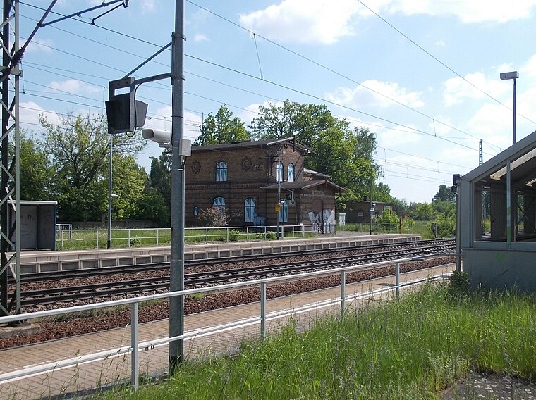
Photo: Jwaller, CC BY-SA 3.0.
Radis railway station is situated 3 km southwest of Feriencamp Radis.
Protestant church Radis
Church
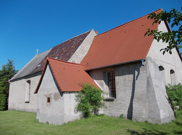
Photo: Jwaller, CC BY-SA 3.0.
Protestant church Radis is situated 3 km southwest of Feriencamp Radis.
Places in the Area
Nearby places include Selbitz and Gohrau.
Selbitz
Village

Photo: Wolkenkratzer, CC BY-SA 4.0.
Selbitz is a village and a former municipality in Wittenberg district in Saxony-Anhalt, Germany. Since 1 January 2010, it is part of the town Kemberg. Selbitz is situated 4½ km north of Feriencamp Radis.
Gohrau
Village
 Gohrau is a village and a former municipality in the district of Wittenberg, Saxony-Anhalt, Germany. Since 1 January 2011, it is part of the town Oranienbaum-Wörlitz. Gohrau is situated 5 km northwest of Feriencamp Radis.
Rehsen
Village

Photo: Schrotti(at)horstdorf, CC BY-SA 3.0.
Rehsen is a village and a former municipality in the district of Wittenberg, Saxony-Anhalt, Germany. Since 1 January 2011, it is part of the town Oranienbaum-Wörlitz. Rehsen is situated 6 km northwest of Feriencamp Radis.
Feriencamp Radis
- Categories: tourism and transportation
- Location: Kemberg, Wittenberg, Saxony-Anhalt, Germany, Central Europe, Europe
- View on OpenStreetMap
Latitude
51.77493° or 51° 46′ 30″ northLongitude
12.53512° or 12° 32′ 6″ eastOpen location code
9F3JQGFP+X2OpenStreetMap ID
node 3070164034OpenStreetMap feature
tourism=caravan_siteOpenStreetMap attribute
wheelchair=no
This page is based on OpenStreetMap, Wikidata, and Wikimedia Commons.
We’d love your help improving our open data sources. Thank you for contributing.
Satellite Map
Discover Feriencamp Radis from above in high-definition satellite imagery.
Notable Places Nearby
Highlights include Reudener Tor and Bungalow-Siedlung Roter See.
Nearby Places
Explore places such as Feriencamp Radis and Parktasche ‘Reudener Tor’.
Saxony-Anhalt: Must-Visit Destinations
Delve into Magdeburg, Halle, Wittenberg, and Quedlinburg.
Curious Motorhome Stopovers to Discover
Uncover intriguing motorhome stopovers from every corner of the globe.
About Mapcarta. Data © OpenStreetMap contributors and available under the Open Database License". Text is available under the CC BY-SA 4.0 license, except for photos, directions, and the map. Photo: GMM, Public domain.