Fort Kol-La
Fort Kol-La is a peak in Nador Province, Oriental. Fort Kol-La is situated nearby to the village Sidi Moussa, as well as near Douar Iqodhadhen.| Tap on a place to explore it |
Places of Interest
Highlights include Mount Gourougou.
Mount Gourougou
Peak

Photo: Miguel González Novo, CC BY-SA 2.0.
Mount Gurugu is a rural area in Morocco located almost entirely in the town of Bni Chiker near the province of Nador. The mountain is densely populated, with no proper census having been done within the area, rather relying on the amount of houses visible.
Places in the Area
Nearby places include Beni Ansar and Farkhana.
Beni Ansar
Town
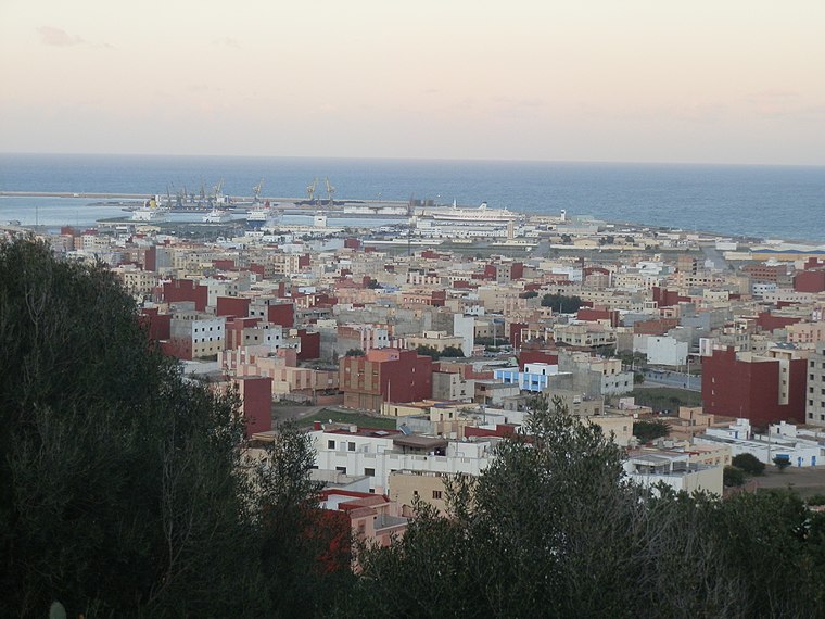
Photo: Aït Nsar, CC BY-SA 3.0.
Beni Ansar is a town in Nador Province, Oriental, Morocco, located 12 km north of the city of Nador. It is bordered on the north by the Spanish city of Melilla.
Farkhana
Town
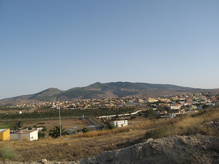
Photo: Ángel Gutiérrez Rubio, CC BY 2.0.
Farkhana is a town in Nador Province, Oriental, Morocco. According to the 2004 census, it has a population of 10,994.
Fort Kol-La
- Type: Peak
- Category: landform
- Location: Nador Province, Oriental, Morocco, North Africa, Africa
- View on OpenStreetMap
Latitude
35.2264° or 35° 13′ 35″ northLongitude
-2.9683° or 2° 58′ 6″ westOpen location code
8C7V62GJ+HMOpenStreetMap ID
node 3072418955OpenStreetMap feature
natural=peak
This page is based on OpenStreetMap, Wikidata, and Wikimedia Commons.
We’d love your help improving our open data sources. Thank you for contributing.
Satellite Map
Discover Fort Kol-La from above in high-definition satellite imagery.
In Other Languages
From French to Spanish—“Fort Kol-La” goes by many names.
- French: “Fort Kol-La”
- Spanish: “Fuerte Kol-La”
Localities in the Area
Explore places such as Sidi Moussa and Douar Iqodhadhen.
Notable Places Nearby
Highlights include Valhalla Paradise and TZADIK RABBI SAADIA EDARY.
Morocco: Must-Visit Destinations
Delve into Marrakech, Casablanca, Fez, and Rabat.
Curious Peaks to Discover
Uncover intriguing peaks from every corner of the globe.
About Mapcarta. Data © OpenStreetMap contributors and available under the Open Database License". Text is available under the CC BY-SA 4.0 license, except for photos, directions, and the map. Photo: Chrizirox, CC BY-SA 3.0.