Fatih Moschee
Fatih Moschee is a mosque in Helmstedt, Brunswick Land, Lower Saxony. Fatih Moschee is situated nearby to the playground Mehrgenerationen Spielplatz, as well as near the shopping center Marktpassage.| Tap on a place to explore it |
Places of Interest Nearby
Highlights include Juleum and Helmstedt town hall.
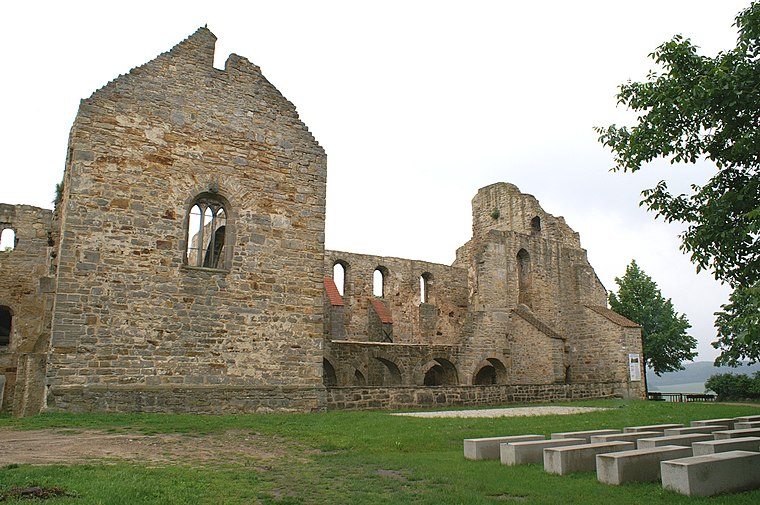
Juleum
Museum

Photo: Wikimedia, CC BY-SA 3.0.
Juleum is a museum, which is situated 150 metres west of Fatih Moschee.
Helmstedt town hall
Town hall

Photo: Kyl0e, CC BY-SA 4.0.
Helmstedt town hall is situated 170 metres south of Fatih Moschee.
St. Walpurgis
Church

Photo: Hejkal, CC BY-SA 3.0 de.
St. Walpurgis is a church, which is situated 210 metres north of Fatih Moschee.
Places in the Area
Nearby places include Mariental and Wolsdorf.
Mariental
Village

Photo: Harald Hartge, Public domain.
Mariental is a municipality in the district of Helmstedt, in Lower Saxony, Germany. The Municipality Mariental includes the villages of Mariental-Dorf and Mariental-Horst. See also Mariental Abbey. Mariental is situated 6 km north of Fatih Moschee.
Wolsdorf
Village

Photo: Kirchenfan, CC0.
Wolsdorf is a municipality in the district of Helmstedt, in Lower Saxony, Germany. Wolsdorf is situated 6 km southwest of Fatih Moschee.
Walbeck
Village
 Walbeck is a village and a former municipality in the Börde district in Saxony-Anhalt, Germany. Since 1 January 2010, it is part of the town Oebisfelde-Weferlingen. Its population is 688. Walbeck is situated 7 km northeast of Fatih Moschee.
Fatih Moschee
- Type: Mosque
- Categories: place of worship and religion
- Location: Helmstedt, Helmstedt (district), Brunswick Land, Lower Saxony, Germany, Central Europe, Europe
- View on OpenStreetMap
Latitude
52.22884° or 52° 13′ 44″ northLongitude
11.01076° or 11° 0′ 39″ eastOpen location code
9F4H62H6+G8OpenStreetMap ID
node 3087764667OpenStreetMap feature
amenity=place_of_worship
This page is based on OpenStreetMap, Wikidata, and Wikimedia Commons.
We’d love your help improving our open data sources. Thank you for contributing.
Satellite Map
Discover Fatih Moschee from above in high-definition satellite imagery.
Places with the Same Name
Discover other places named “Fatih Moschee”.
Notable Places Nearby
Highlights include Mehrgenerationen Spielplatz and Marktpassage.
Nearby Places
Explore places such as Horst Lilienfeld and Martha Lilienfeld geb.Mildenberg.
Brunswick Land: Must-Visit Destinations
Delve into Brunswick, Wolfsburg, Salzgitter, and Wolfenbüttel.
Curious Mosques to Discover
Uncover intriguing mosques from every corner of the globe.
About Mapcarta. Data © OpenStreetMap contributors and available under the Open Database License". Text is available under the CC BY-SA 4.0 license, except for photos, directions, and the map. Photo: Times, CC BY-SA 3.0.