Laatzen/Rethener Winkel
Laatzen/Rethener Winkel is a tram stop in Laatzen, Hanover Region, Lower Saxony. Laatzen/Rethener Winkel is situated nearby to the cemetery Friedhof Im Heidfeld, as well as near the pitch Sportplatz Albert-Einstein-Schule.| Tap on a place to explore it |
Places of Interest Nearby
Highlights include Friedhof Im Heidfeld and Rethen (Leine).
Friedhof Im Heidfeld
Cemetery

Photo: Bernd Schwabe in Hannover, CC BY-SA 3.0.
Friedhof Im Heidfeld is a cemetery, which is situated 160 metres northwest of Laatzen/Rethener Winkel.
Rethen (Leine)
Railway station
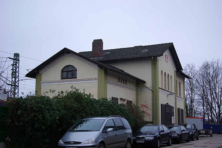
Photo: Clemensfranz, CC BY-SA 3.0.
Rethen (Leine) is a railway station, which is situated 1¼ km south of Laatzen/Rethener Winkel.
Leine-Center Laatzen
Shopping center

Photo: Wikimedia, CC BY-SA 3.0.
Leine-Center Laatzen is a shopping center, which is situated 1¼ km north of Laatzen/Rethener Winkel.
Places in the Area
Nearby places include Rethen and Laatzen.
Rethen
Suburb
Rethen is a part of the town of Laatzen in the district of Hanover, in Lower Saxony, Germany. It is situated south of both Hanover and the center of Laatzen.
Laatzen
Town
Laatzen is a town in Hanover Region, in Lower Saxony, Germany. It is situated directly south of Hanover.
Gleidingen
Suburb

Photo: Smiley.toerist, CC BY-SA 4.0.
Gleidingen is a part of the town of Laatzen in the district of Hanover, in Lower Saxony, Germany. It is situated south of both Hanover and the center of Laatzen. Gleidingen is situated 3 km southeast of Laatzen/Rethener Winkel.
Laatzen/Rethener Winkel
- Type: Tram stop
- Wheelchair access: no
- Categories: railway stop, transport stop, and transportation
- Location: Laatzen, Hanover Region, Lower Saxony, Germany, Central Europe, Europe
- View on OpenStreetMap
Latitude
52.29681° or 52° 17′ 49″ northLongitude
9.8177° or 9° 49′ 4″ eastOpen location code
9F4F7RW9+P3OpenStreetMap ID
node 3113233798OpenStreetMap feature
public_transport=stop_positionOpenStreetMap feature
railway=tram_stopOpenStreetMap attribute
wheelchair=no
This page is based on OpenStreetMap, Wikidata, and Wikimedia Commons.
We’d love your help improving our open data sources. Thank you for contributing.
Satellite Map
Discover Laatzen/Rethener Winkel from above in high-definition satellite imagery.
Notable Places Nearby
Highlights include Sportplatz Albert-Einstein-Schule and Bolzplatz.
Nearby Places
Explore places such as Laatzen/Rethener Winkel and McDonald’s.
Hanover Region: Must-Visit Destinations
Delve into Hanover, Hildesheim, Nienburg, and Verden an der Aller.
Curious Tram Stops to Discover
Uncover intriguing tram stops from every corner of the globe.
About Mapcarta. Data © OpenStreetMap contributors and available under the Open Database License". Text is available under the CC BY-SA 4.0 license, except for photos, directions, and the map. Photo: Ukko.de, CC BY-SA 3.0.