Ca n’Àgueda
Ca n’Àgueda is a convenience store in Santa Maria del Camí, Balearic Islands which is located on plaça Andreu Torrens. Ca n’Àgueda is situated nearby to the community center Casal de Joves, as well as near the pitch Pàdel esPunt.| Tap on a place to explore it |
- Opening hours:
Tuesday—Friday: 8:30 AM—1:30 PM or later and 5:30 PM—8:00 PM
Saturday and Sunday: 8:30 AM—1:30 PM - Type: Convenience store
- Address: plaça Andreu Torrens 2, Santa Maria del Camí, Illes Balears 07320
- Wheelchair access: no
Places of Interest Nearby
Highlights include Església de la Mare de Déu de la Soledat and Santa Maria del Camí town hall.
Església de la Mare de Déu de la Soledat
Church

Photo: MARIA ROSA FERRE ✿, CC BY-SA 2.0.
Església de la Mare de Déu de la Soledat is a church, which is situated 360 metres north of Ca n’Àgueda.
Santa Maria del Camí town hall
Town hall
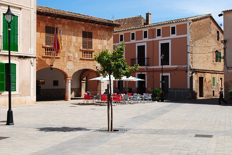
Photo: Rotget, CC BY-SA 3.0.
Santa Maria del Camí town hall is situated 540 metres east of Ca n’Àgueda.
Santa Maria del Camí train station
Railway station

Photo: Wikimedia, CC BY-SA 3.0.
Santa Maria del Camí train station is a railway station, which is situated 590 metres north of Ca n’Àgueda.
Places in the Area
Nearby places include sa Cabaneta and Son Seguí de Passatemps.
sa Cabaneta
Suburb

Photo: Chixoy, CC BY-SA 3.0.
sa Cabaneta is a suburb, which is situated 3½ km southwest of Ca n’Àgueda.
Son Seguí de Passatemps
Locality

Photo: Rotget, CC BY-SA 3.0.
Son Seguí de Passatemps is a locality, which is situated 3½ km southeast of Ca n’Àgueda.
Marratxí
Town

Photo: Chixoy, Public domain.
Marratxí is a municipality in the Raiguer region of Majorca, one of the Balearic Islands of Spain. As of 2005, it has a population of 28,237 and an area of 54 km2. Marratxí is situated 4 km southwest of Ca n’Àgueda.
Ca n’Àgueda
- Categories: shop and food
- Location: Santa Maria del Camí, Balearic Islands, Spain, Iberia, Europe
- View on OpenStreetMap
Latitude
39.648° or 39° 38′ 53″ northLongitude
2.77256° or 2° 46′ 21″ eastOpen location code
8FF4JQXF+52OpenStreetMap ID
node 3126282803OpenStreetMap feature
shop=convenienceOpenStreetMap attribute
wheelchair=no
This page is based on OpenStreetMap, Wikidata, and Wikimedia Commons.
We’d love your help improving our open data sources. Thank you for contributing.
Satellite Map
Discover Ca n’Àgueda from above in high-definition satellite imagery.
Notable Places Nearby
Highlights include Casal de Joves and Pàdel esPunt.
Nearby Places
Explore places such as Escola Graduada and EAP Equip d’Atenció Primerenca Mallorca Centre.
Balearic Islands: Must-Visit Destinations
Delve into Palma de Mallorca, Formentera, Ibiza, and Maó.
Curious Convenience Stores to Discover
Uncover intriguing convenience stores from every corner of the globe.
About Mapcarta. Data © OpenStreetMap contributors and available under the Open Database License". Text is available under the CC BY-SA 4.0 license, except for photos, directions, and the map. Photo: anieto2k, CC BY-SA 2.0.