Vista Guama
Vista Guama is a restaurant in Santiago del Teide, Santa Cruz de Tenerife which is located on Avenida Coronel Gorrín. Vista Guama is situated nearby to the reservoir Depósito Tamaimo, as well as near the peak Morro de la Vera.| Tap on a place to explore it |
Places of Interest Nearby
Highlights include Iglesia de San Fernando Rey and Playa Los Gigantes.
Iglesia de San Fernando Rey
Church

Photo: Florival fr, CC BY-SA 3.0.
Iglesia de San Fernando Rey is a church, which is situated 2½ km north of Vista Guama.
Playa Los Gigantes
Beach

Photo: Mike Peel, CC BY-SA 4.0.
Playa Los Gigantes is a beach, which is situated 3½ km southwest of Vista Guama.
Places in the Area
Nearby places include Tamaimo and El Retamar.
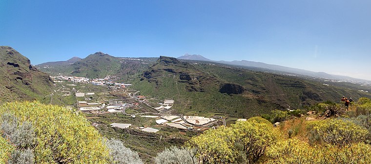
Las Manchas
Suburb

Photo: Wouterhagens, CC BY-SA 4.0.
Las Manchas is a locality in the municipality of Santiago del Teide in the island of Tenerife.
Vista Guama
- Type: Restaurant
- Address: Avenida Coronel Gorrín 80, 38684
- Category: food
- Location: Santiago del Teide, Santa Cruz de Tenerife, Tenerife, Canary Islands, Spain, Iberia, Europe
- View on OpenStreetMap
Latitude
28.27374° or 28° 16′ 26″ northLongitude
-16.81688° or 16° 49′ 1″ westOpen location code
7CW575FM+F6OpenStreetMap ID
node 314031888OpenStreetMap feature
amenity=restaurant
This page is based on OpenStreetMap, Wikidata, and Wikimedia Commons.
We’d love your help improving our open data sources. Thank you for contributing.
Satellite Map
Discover Vista Guama from above in high-definition satellite imagery.
Notable Places Nearby
Highlights include Depósito Tamaimo and Morro de la Vera.
Nearby Places
Explore places such as Tamaimo Norte and Cooperativa.
Tenerife: Must-Visit Destinations
Delve into Santa Cruz de Tenerife, San Cristóbal de La Laguna, Teide National Park, and Puerto de la Cruz.
Curious Restaurants to Discover
Uncover intriguing restaurants from every corner of the globe.
About Mapcarta. Data © OpenStreetMap contributors and available under the Open Database License". Text is available under the CC BY-SA 4.0 license, except for photos, directions, and the map. Photo: Wikimedia, CC BY-SA 4.0.