Atalayon
Atalayon is a marina in Nador Province, Oriental. Atalayon is situated nearby to the town Beni Ansar.| Tap on a place to explore it |
Places in the Area
Nearby places include Nador and Beni Ansar.
Nador

Photo: Tonkie, CC BY-SA 3.0.
Nador is a coastal city and provincial capital in the northeastern Rif region of Morocco with a population of about 158,202. The Nador Province has over 600,000 inhabitants. Nador is considered the second largest city in the Oriental Region after Oujda.
Beni Ansar
Town
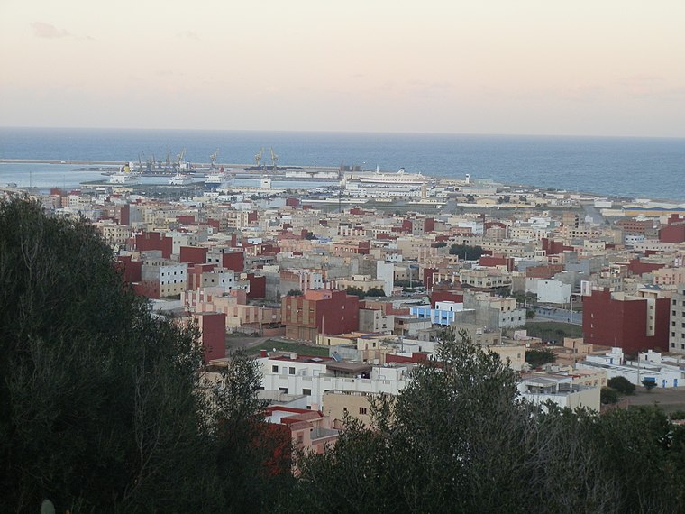
Photo: Aït Nsar, CC BY-SA 3.0.
Beni Ansar is a town in Nador Province, Oriental, Morocco, located 12 km north of the city of Nador. It is bordered on the north by the Spanish city of Melilla. Beni Ansar is situated 6 km northwest of Atalayon.
Melilla

Photo: Ecemaml, CC BY-SA 3.0.
Melilla is a charming Spanish exclave in North Africa, with a small surface area of just 14 km² and a population of around 85,000 inhabitants, 130 km from the Spanish mainland, in the heart of the Rif region, bordered to the east by the Alboran Sea and to the south by Morocco.
Atalayon
- Type: Marina
- Categories: recreation area and transportation
- Location: Nador Province, Oriental, Morocco, North Africa, Africa
- View on OpenStreetMap
Latitude
35.21666° or 35° 13′ northLongitude
-2.90303° or 2° 54′ 11″ westOpen location code
8C7V638W+MQOpenStreetMap ID
node 3168650069OpenStreetMap feature
leisure=marina
This page is based on OpenStreetMap, Wikidata, and Wikimedia Commons.
We’d love your help improving our open data sources. Thank you for contributing.
Satellite Map
Discover Atalayon from above in high-definition satellite imagery.
Places with the Same Name
Discover other places named “Atalayon”.
Notable Places Nearby
Highlights include Palais Royal de Nador and Bocana.
Nearby Places
Explore places such as Rd Point Atalayoun and Point Palais Royal.
Morocco: Must-Visit Destinations
Delve into Marrakech, Casablanca, Fez, and Rabat.
Curious Marinas to Discover
Uncover intriguing marinas from every corner of the globe.
About Mapcarta. Data © OpenStreetMap contributors and available under the Open Database License". Text is available under the CC BY-SA 4.0 license, except for photos, directions, and the map. Photo: Chrizirox, CC BY-SA 3.0.