Vehkalan asema
Vehkalan asema is a bicycle parking in Vantaa, Helsinki sub-region, Uusimaa. Vehkalan asema is situated nearby to Vehkala railway station, as well as near the park Härkäpuisto.| Tap on a place to explore it |
Places of Interest Nearby
Highlights include Vehkala railway station and Vantaankoski bridge.
Vehkala railway station
Railway station
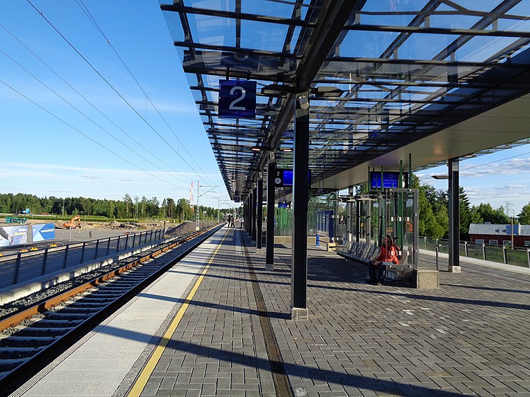
Photo: Junafani, CC BY-SA 4.0.
Vehkala railway station is a Helsinki commuter rail station located in the district of Myllymäki in Vantaa, Finland. It is one of the new stations of the Ring Rail Line, which opened in July 2015.
Vantaankoski bridge

Photo: Paju, CC BY-SA 4.0.
Vantaankoski bridge is situated 1¼ km east of Vehkalan asema.
Martinlaakso shopping center
Shopping center
 Martinlaakso shopping center is situated 2 km south of Vehkalan asema.
Places in the Area
Nearby places include Martinlaakso and Petikko.
Martinlaakso
Suburb

Photo: Paju, CC BY-SA 3.0.
Martinlaakso is a district in Vantaa, Finland. Located in the Myyrmäki major region, it is the second most populous district in all of Vantaa, after Myyrmäki itself.


Vehkalan asema
- Type: Bicycle parking
- Category: transportation
- Location: Vantaa, Helsinki sub-region, Uusimaa, Southern Finland, Finland, Nordic countries, Europe
- View on OpenStreetMap
Latitude
60.29503° or 60° 17′ 42″ northLongitude
24.84365° or 24° 50′ 37″ eastOpen location code
9GG67RWV+2FOpenStreetMap ID
node 3174944821OpenStreetMap feature
amenity=bicycle_parking
This page is based on OpenStreetMap, Wikidata, and Wikimedia Commons.
We’d love your help improving our open data sources. Thank you for contributing.
Satellite Map
Discover Vehkalan asema from above in high-definition satellite imagery.
Notable Places Nearby
Highlights include Härkäpuisto and Myllymäenpuisto.
Nearby Places
Explore places such as Vehkalan asema and Vehkala station.
Uusimaa: Must-Visit Destinations
Delve into Helsinki, Espoo, Porvoo, and Lohja.
Curious Bicycle Parkings to Discover
Uncover intriguing bicycle parkings from every corner of the globe.
About Mapcarta. Data © OpenStreetMap contributors and available under the Open Database License". Text is available under the CC BY-SA 4.0 license, except for photos, directions, and the map. Photo: Wikimedia, CC0.