Parabús Curridabat 181454
Parabús Curridabat 181454 is a bus stop in Curridabat, San José Province. Parabús Curridabat 181454 is situated nearby to the library Biblioteca Municipal José Basileo Acuña, as well as near the church Parroquia San Antonio de Padua.| Tap on a place to explore it |
Places of Interest Nearby
Highlights include Parroquia San Antonio de Padua and Parque Okayama.
Parroquia San Antonio de Padua
Church
The Parroquia San Antonio de Padua, commonly known as the Iglesia de Curridabat is a church located in Curridabat, Costa Rica. Parroquia San Antonio de Padua is situated 160 metres northwest of Parabús Curridabat 181454.
Parque Okayama
Park

Photo: ArquiWHAT, Public domain.
Parque Okayama is a park, which is situated 2½ km southwest of Parabús Curridabat 181454.
Estadio Ecológico
Stadium
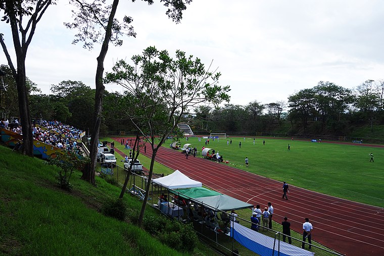
Photo: Wikimedia, CC BY-SA 3.0.
Estadio Ecológico is a stadium, which is situated 3½ km north of Parabús Curridabat 181454.
Places in the Area
Nearby places include Curridabat and Tirrases.
Curridabat
Town

Photo: JosephC5, CC BY-SA 4.0.
Curridabat is a prosperous suburb of San José on the route east to Cartago. There are boutique shops, malls, and upscale neighborhoods in Curridabat.
Tirrases
Village
Tirrases is a district of the Curridabat canton, in the San José province of Costa Rica.
San Pedro de Montes de Oca
Town

Photo: Wikimedia, CC BY-SA 3.0.
San Pedro de Montes de Oca is a city in the Central Valley of Costa Rica east of the capital, San José. It is the main city in the canton of Montes de Oca, and is best known as the location of the University of Costa Rica, the largest public university in the country. San Pedro de Montes de Oca is situated 2½ km northwest of Parabús Curridabat 181454.
Parabús Curridabat 181454
- Type: Bus stop
- Category: transportation
- Location: Curridabat, San José Province, Costa Rica, Central America, North America
- View on OpenStreetMap
Latitude
9.91365° or 9° 54′ 49″ northLongitude
-84.03589° or 84° 2′ 9″ westOpen location code
66XQWX77+FJOpenStreetMap ID
node 3175099425OpenStreetMap feature
highway=bus_stop
This page is based on OpenStreetMap, Wikidata, and Wikimedia Commons.
We’d love your help improving our open data sources. Thank you for contributing.
Satellite Map
Discover Parabús Curridabat 181454 from above in high-definition satellite imagery.
Notable Places Nearby
Highlights include Biblioteca Municipal José Basileo Acuña and Centro Cristiano Renacer.
Nearby Places
Explore places such as Voltronics and Floristería Antares.
Costa Rica: Must-Visit Destinations
Delve into San José, Alajuela, Puerto Limón, and Liberia.
Curious Bus Stops to Discover
Uncover intriguing bus stops from every corner of the globe.
About Mapcarta. Data © OpenStreetMap contributors and available under the Open Database License". Text is available under the CC BY-SA 4.0 license, except for photos, directions, and the map. Photo: Andy Rusch, CC BY 2.0.