Imst, Emil-Leys-Straße
Imst, Emil-Leys-Straße is a bus stop in Imst, Tyrol. Imst, Emil-Leys-Straße is situated nearby to the playground Spielplatz Volksschule Hermann Gmeiner, as well as near the pitch Sportplatz Sonnberg.| Tap on a place to explore it |
Places of Interest Nearby
Highlights include Museum im Ballhaus and Kapuzinerkirche und -kloster.

Kapuzinerkirche und -kloster
Church
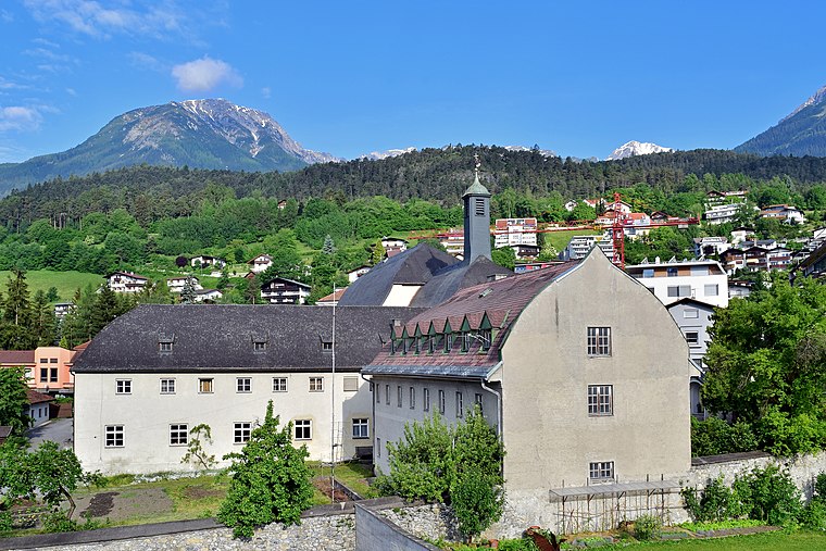
Photo: Haeferl, CC BY-SA 3.0 at.
Kapuzinerkirche und -kloster is a church, which is situated 1¼ km northeast of Imst, Emil-Leys-Straße.
Franziskusbrunnen
Fountain

Photo: Haeferl, CC BY-SA 3.0 at.
Franziskusbrunnen is a fountain, which is situated 1¼ km northeast of Imst, Emil-Leys-Straße.
Places in the Area
Nearby places include Ötztal-Bahnhof.
Ötztal-Bahnhof
Village

Photo: Simon04, CC BY-SA 4.0.
Ötztal-Bahnhof is a village, which is situated 10 km east of Imst, Emil-Leys-Straße.
Imst, Emil-Leys-Straße
- Type: Bus stop
- Categories: transport stop and transportation
- Location: Imst, Imst District, Tyrol, Austria, Central Europe, Europe
- View on OpenStreetMap
Latitude
47.23013° or 47° 13′ 49″ northLongitude
10.72936° or 10° 43′ 46″ eastOpen location code
8FVG6PJH+3POpenStreetMap ID
node 321158631OpenStreetMap feature
public_transport=stop_position
This page is based on OpenStreetMap, Wikidata, and Wikimedia Commons.
We’d love your help improving our open data sources. Thank you for contributing.
Satellite Map
Discover Imst, Emil-Leys-Straße from above in high-definition satellite imagery.
Notable Places Nearby
Highlights include Spielplatz Volksschule Hermann Gmeiner and Sportplatz Sonnberg.
Nearby Places
Explore places such as Emil-Leys-Straße and Imst, Hermann-Gmeiner-Straße.
Tyrol: Must-Visit Destinations
Delve into Innsbruck, Kufstein, Lienz, and Kitzbühel.
Curious Bus Stops to Discover
Uncover intriguing bus stops from every corner of the globe.
About Mapcarta. Data © OpenStreetMap contributors and available under the Open Database License". Text is available under the CC BY-SA 4.0 license, except for photos, directions, and the map. Photo: Traveler100, CC BY-SA 3.0.