Iglesia Cristiana El Reino de los Cielos
Iglesia Cristiana El Reino de los Cielos is a church in San Fernando Department, Chaco. Iglesia Cristiana El Reino de los Cielos is situated nearby to the church Ministerio Tiempo de Dios, as well as near Capilla Nuestra Señora de Itatí.| Tap on a place to explore it |
Places of Interest Nearby
Highlights include San Buenaventura del Monte Alto.
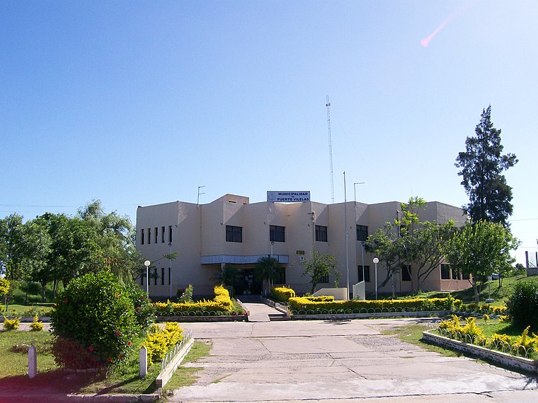
San Buenaventura del Monte Alto
Church

Photo: Wikimedia, CC BY-SA 3.0.
San Buenaventura del Monte Alto is a church, which is situated 3½ km north of Iglesia Cristiana El Reino de los Cielos.
Places in the Area
Nearby places include Barranqueras and La Liguria.
Barranqueras
Town
 Barranqueras is a city in the southeast of the province of Chaco, Argentina, on a small tributary river on the right-hand-side shore of the Paraná River, only 7 km from the provincial capital Resistencia and within its metropolitan area.
La Liguria
Neighborhood
La Liguria is a village and municipality in Chaco Province in northern Argentina. La Liguria is situated 2½ km west of Iglesia Cristiana El Reino de los Cielos.
Puerto Vilelas
Village
 Puerto Vilelas is a village and municipality in Chaco Province, in northern Argentina. Puerto Vilelas is situated 5 km south of Iglesia Cristiana El Reino de los Cielos.
Iglesia Cristiana El Reino de los Cielos
- Type: Church
- Categories: place of worship and religion
- Location: San Fernando Department, Chaco, Argentina, South America
- View on OpenStreetMap
Latitude
-27.47475° or 27° 28′ 29″ southLongitude
-58.92742° or 58° 55′ 39″ westOpen location code
5843G3GF+42OpenStreetMap ID
node 3238674156OpenStreetMap feature
amenity=place_of_worship
This page is based on OpenStreetMap, Wikidata, and Wikimedia Commons.
We’d love your help improving our open data sources. Thank you for contributing.
Satellite Map
Discover Iglesia Cristiana El Reino de los Cielos from above in high-definition satellite imagery.
Notable Places Nearby
Highlights include Ministerio Tiempo de Dios and Capilla Nuestra Señora de Itatí.
Nearby Places
Explore places such as Alegre and Lavadero HL.
Chaco: Must-Visit Destinations
Delve into Resistencia, Formosa, Clorinda, and Río Pilcomayo National Park.
Curious Churches to Discover
Uncover intriguing churches from every corner of the globe.
About Mapcarta. Data © OpenStreetMap contributors and available under the Open Database License". Text is available under the CC BY-SA 4.0 license, except for photos, directions, and the map. Photo: Wikimedia, CC0.