Labor Lyceum
Labor Lyceum is in Old Toronto, Toronto, Ontario. Labor Lyceum is situated nearby to the synagogue Anshei Minsk, as well as near the fast food restaurant Rasta Pasta.| Tap on a place to explore it |
Places of Interest Nearby
Highlights include Yonge-Dundas and Anshei Minsk.
Yonge-Dundas

Photo: Benson Kua, CC BY-SA 2.0.
Yonge-Dundas is the very heart of downtown Toronto—in more ways than one. After all, the major arterials of Yonge Street and Dundas St meet here, and the resulting intersection may be the city's busiest.
Anshei Minsk
Synagogue

Photo: Zlerman, CC BY-SA 3.0.
Anshei Minsk is a synagogue in the Kensington Market neighbourhood of Toronto, Ontario, Canada. It was founded in 1912 by poor Jewish immigrants from what is now Belarus, which at the time was part of the Russian Empire.
Art Gallery of Ontario
Museum
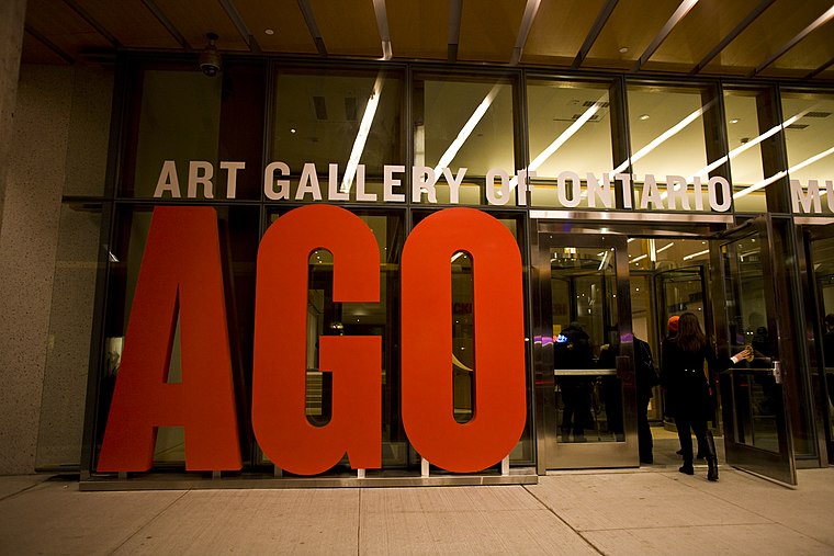
Photo: Owen Byrne, CC BY 2.0.
The Art Gallery of Ontario is an art museum in Toronto, Ontario, Canada. Located on Dundas Street West in the Grange Park neighbourhood of downtown Toronto, the museum complex takes up 45,000 square metres of physical space, making it one of the largest art museums in North America and the second-largest art museum in Toronto, after the Royal Ontario Museum. Art Gallery of Ontario is situated 510 metres east of Labor Lyceum.
Places in the Area
Nearby places include Kensington-Chinatown and Alexandra Park.
Kensington-Chinatown

Photo: dimitri, CC BY-SA 2.0.
Kensington Market and Chinatown are neighbourhoods in the western side of downtown Toronto. Kensington Market is one of the most eclectic and unique locations in the entire city.
Alexandra Park
Neighborhood

Photo: SimonP, CC BY-SA 3.0.
Alexandra Park is a neighbourhood located in downtown Toronto, Ontario, Canada. Alexandra Park is bounded by Dundas Street West on the north, Spadina Avenue on the east, Queen Street West on the south, and Bathurst Street on the west.
Discovery District
Neighborhood

Photo: Cmglee, CC BY-SA 3.0.
The Discovery District is one of the commercial districts in Downtown Toronto, Ontario, Canada. It has a high concentration of hospitals and research institutions, particularly those related to biotechnology.
Labor Lyceum
- Type: Sign
- Categories: information and tourism
- Location: Old Toronto, Toronto, Greater Toronto Area, Ontario, Canada, North America
- View on OpenStreetMap
Latitude
43.65428° or 43° 39′ 15″ northLongitude
-79.39875° or 79° 23′ 56″ westOpen location code
87M2MJ32+PFOpenStreetMap ID
node 3257496313OpenStreetMap feature
tourism=information
This page is based on OpenStreetMap, Wikidata, and Wikimedia Commons.
We’d love your help improving our open data sources. Thank you for contributing.
Satellite Map
Discover Labor Lyceum from above in high-definition satellite imagery.
Places with the Same Name
Discover other places named “Labor Lyceum”.
Notable Places Nearby
Highlights include Rasta Pasta and YSM Evergreen Centre.
Nearby Places
Explore places such as Kensington Market Community Marker and Mr. K.
Toronto: Must-Visit Destinations
Delve into Yorkville and the Annex, Midtown, East End, and Downtown East.
Curious Places to Discover
Uncover intriguing places from every corner of the globe.
About Mapcarta. Data © OpenStreetMap contributors and available under the Open Database License". Text is available under the CC BY-SA 4.0 license, except for photos, directions, and the map. Photo: S23678, CC BY-SA 3.0.