Das Ei von Lichtenwald
Das Ei von Lichtenwald is a work of art in Lichtenwald, Landkreis Esslingen, Baden-Württemberg. Das Ei von Lichtenwald is situated nearby to the church Heilig-Kreuz-Kirche, as well as near the library Ortsbücherei Lichtenwald.| Tap on a place to explore it |
Places of Interest Nearby
Highlights include Aegidiuskirche and Rathaus Baltmannsweiler.
Aegidiuskirche
Church

Photo: MTheiler, CC BY-SA 4.0.
Aegidiuskirche is a church, which is situated 2½ km northwest of Das Ei von Lichtenwald.
Rathaus Baltmannsweiler
Town hall
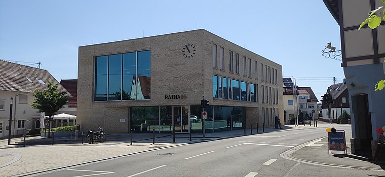
Photo: MTheiler, CC BY-SA 4.0.
Rathaus Baltmannsweiler is a town hall, which is situated 2½ km northwest of Das Ei von Lichtenwald.
Ebersbach station
Railway station

Photo: Baron2105, CC BY-SA 3.0.
Ebersbach station is located at the 32 kilometre point of the Fils Valley Railway in the German state of Baden-Württemberg. Ebersbach station is situated 4 km southeast of Das Ei von Lichtenwald.
Places in the Area
Nearby places include Ebersbach an der Fils and Deizisau.
Ebersbach an der Fils
Town

Photo: Wikimedia, Public domain.
Ebersbach an der Fils is a town in the district of Göppingen in Baden-Württemberg, in southern Germany. Ebersbach an der Fils is situated 4 km southeast of Das Ei von Lichtenwald.
Deizisau
Village
 Deizisau is a town in the district of Esslingen in Baden-Württemberg in southern Germany. It belongs to the Stuttgart Region and the Stuttgart Metropolitan Region. Deizisau is situated 7 km west of Das Ei von Lichtenwald.
Winterbach
Village
 Winterbach is a municipality in the district of Rems-Murr in Baden-Württemberg in Germany. Winterbach is situated 8 km north of Das Ei von Lichtenwald.
Das Ei von Lichtenwald
- Type: Work of art
- Artwork_type: sculpture
- Category: tourism
- Location: Lichtenwald, Landkreis Esslingen, Stuttgart, Baden-Württemberg, Germany, Central Europe, Europe
- View on OpenStreetMap
Latitude
48.7315° or 48° 43′ 53″ northLongitude
9.48085° or 9° 28′ 51″ eastOpen location code
8FWFPFJJ+H8OpenStreetMap ID
node 3260589512OpenStreetMap feature
tourism=artworkOpenStreetMap attribute
artwork_type=sculpture
This page is based on OpenStreetMap, Wikidata, and Wikimedia Commons.
We’d love your help improving our open data sources. Thank you for contributing.
Satellite Map
Discover Das Ei von Lichtenwald from above in high-definition satellite imagery.
Notable Places Nearby
Highlights include Heilig-Kreuz-Kirche and Ortsbücherei Lichtenwald.
Nearby Places
Explore places such as Naturfreunde-Ferienheim Schurwaldhaus and Haug’s Schurwaldbesen.
Baden-Württemberg: Must-Visit Destinations
Delve into Stuttgart, Heidelberg, Karlsruhe, and Mannheim.
Curious Work Of Arts to Discover
Uncover intriguing work of arts from every corner of the globe.
About Mapcarta. Data © OpenStreetMap contributors and available under the Open Database License". Text is available under the CC BY-SA 4.0 license, except for photos, directions, and the map. Photo: Traveler100, CC BY-SA 3.0.