Rathballylong
Rathballylong is a locality in County Wicklow, Leinster. Rathballylong is situated nearby to the locality Tulfarris, as well as near Baltyboys Upper.| Tap on a place to explore it |
Places of Interest
Highlights include Poulaphouca Reservoir and St Joseph’s Church.
Poulaphouca Reservoir
Power station

Photo: 瑞丽江的河水, CC BY-SA 4.0.
Poulaphouca Reservoir, officially Pollaphuca, is an active reservoir and area of wild bird conservation in west County Wicklow, Ireland named after the Poulaphouca waterfall on its south-western end where the water exits the lake. Poulaphouca Reservoir is situated 3 km west of Rathballylong.
St Joseph’s Church
Church

Photo: Patrick Wyse Jackson, CC BY-SA 4.0.
St Joseph’s Church is situated 2½ km southeast of Rathballylong.
Russborough House
House

Photo: Ramón, CC BY-SA 2.0.
Russborough House is a Georgian Palladian house between Blessington and Ballymore Eustace near the Blessington Lakes in County Wicklow, Ireland. The house was designed by Richard Castle for Joseph Leeson, 1st Earl of Milltown and built between 1741 and 1755.
Places in the Area
Nearby places include Valleymount and Ballyknockan.
Valleymount
Village
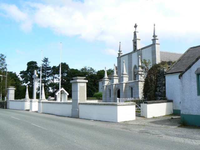
Photo: James Allan, CC BY-SA 2.0.
Valleymount is a small village in western County Wicklow, Ireland. The name 'Valleymount' does not appear before 1839. Previously, the village was known as 'the Cross of Ballymore' or simply 'the Cross', with 'cross' referring to land belonging to the church. Valleymount is situated 2½ km southeast of Rathballylong.
Ballyknockan
Village

Photo: Jonathan Billinger, CC BY-SA 2.0.
Ballyknockan or Ballynockan is a village and townland in County Wicklow, Ireland. Ballyknockan is situated on the western edge of a large granite band extending from Dublin Bay to County Carlow. Ballyknockan is situated 4 km southeast of Rathballylong.
Lacken
Hamlet
Lacken or Lackan is a townland and small village in the west of County Wicklow, Ireland, located on the shores of the Blessington lakes and western edge of the Wicklow Mountains. Lacken is situated 4½ km east of Rathballylong.
Rathballylong
- Type: Locality
- Location: County Wicklow, Leinster, East Coast and Midlands, Ireland, Britain and Ireland, Europe
- View on OpenStreetMap
Latitude
53.12597° or 53° 7′ 34″ northLongitude
-6.54858° or 6° 32′ 55″ westOpen location code
9C5M4FG2+9HOpenStreetMap ID
node 3285612251OpenStreetMap feature
place=locality
This page is based on OpenStreetMap, Wikidata, and Wikimedia Commons.
We’d love your help improving our open data sources. Thank you for contributing.
Satellite Map
Discover Rathballylong from above in high-definition satellite imagery.
Localities in the Area
Explore places such as Tulfarris and Baltyboys Upper.
Notable Places Nearby
Highlights include Rathbally House and Tulfarris Hotel and Golf Resort.
County Wicklow: Must-Visit Destinations
Delve into Bray, Wicklow Town, Arklow, and Glendalough.
Curious Localities to Discover
Uncover intriguing localities from every corner of the globe.
About Mapcarta. Data © OpenStreetMap contributors and available under the Open Database License". Text is available under the CC BY-SA 4.0 license, except for photos, directions, and the map. Photo: Wikimedia, CC BY-SA 3.0.