Landhaus Eden
Landhaus Eden is a hotel in Soltau, Heidekreis, Lower Saxony which is located on An der Bundesstraße. Landhaus Eden is situated nearby to the fire station Feuerwehr Harber, as well as near the tourism office Information.| Tap on a place to explore it |
- Email: hotel@landhauseden.de
- Type: Hotel
- Address: An der Bundesstraße 4, Soltau, 29614
- Wheelchair access: no
Places of Interest Nearby
Highlights include Designer Outlet Soltau and Colossos - Kampf der Giganten.
Designer Outlet Soltau
Shopping center
 Designer Outlet Soltau is a shopping center, which is situated 1½ km southeast of Landhaus Eden.
Colossos - Kampf der Giganten
Roller coaster
 Colossos - Kampf der Giganten, German for Colossos: Battle of the Giants, is a wooden roller coaster located at Heide Park in Soltau, Lower Saxony, Germany. Colossos - Kampf der Giganten is situated 4 km northwest of Landhaus Eden.
Desert Race
Roller coaster

Photo: TBloemink, CC BY-SA 3.0.
Desert Race is a roller coaster, which is situated 4 km northwest of Landhaus Eden.
Places in the Area
Nearby places include Dittmern and Brümmerhof.
Dittmern
Village
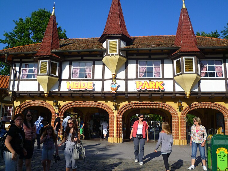
Photo: YanCoasterman, CC BY-SA 3.0.
Dittmern is a village in the borough of Soltau in the Heidekreis district in the German state of Lower Saxony. The village has 783 inhabitants. The hamlets of Friedrichseck, Hambostel, Grüne Aue, Heidenhof and Höpenhof belong to the parish of Dittmern. Dittmern is situated 2½ km north of Landhaus Eden.
Brümmerhof
Hamlet

Photo: NobbiP, CC BY-SA 3.0.
Brümmerhof is a hamlet, which is situated 3 km southeast of Landhaus Eden.
Soltau-Hötzingen
Village

Photo: Wikimedia, CC BY-SA 2.0.
Soltau-Hötzingen is a village, which is situated 4½ km northeast of Landhaus Eden.
Landhaus Eden
- Categories: tourism, accommodation, and building
- Location: Soltau, Heidekreis, Lüneburg Heath, Lower Saxony, Germany, Central Europe, Europe
- View on OpenStreetMap
Latitude
52.99142° or 52° 59′ 29″ northLongitude
9.90713° or 9° 54′ 26″ eastOpen location code
9F4FXWR4+HVOpenStreetMap ID
node 3290569145OpenStreetMap feature
tourism=hotelOpenStreetMap attribute
wheelchair=no
This page is based on OpenStreetMap, Wikidata, and Wikimedia Commons.
We’d love your help improving our open data sources. Thank you for contributing.
Satellite Map
Discover Landhaus Eden from above in high-definition satellite imagery.
Notable Places Nearby
Highlights include Feuerwehr Harber and Information.
Nearby Places
Explore places such as Landhaus Eden and Harber, Abzweig Oeningen.
Lüneburg Heath: Must-Visit Destinations
Delve into Lüneburg, Celle, Gifhorn, and Uelzen.
Curious Hotels to Discover
Uncover intriguing hotels from every corner of the globe.
About Mapcarta. Data © OpenStreetMap contributors and available under the Open Database License". Text is available under the CC BY-SA 4.0 license, except for photos, directions, and the map. Photo: Wikimedia, CC BY-SA 3.0.