Norman Tag Agecny
Norman Tag Agecny is a government office in Cleveland, Oklahoma. Norman Tag Agecny is situated nearby to Andrews Park, as well as near the health club Family Life Center.| Tap on a place to explore it |
Places of Interest Nearby
Highlights include Norman station and Sooner Theatre.
Norman station
Railway station
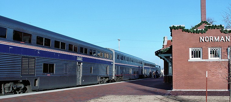
Photo: Ottergoose, CC BY 2.5.
Norman is an Amtrak station in Norman, Oklahoma. The station is serviced by the daily Heartland Flyer, which travels from Fort Worth, Texas to Oklahoma City, Oklahoma. Norman station is situated 2,300 feet east of Norman Tag Agecny.
Sooner Theatre
Theater building

Photo: Michael Barera, CC BY-SA 4.0.
Sooner Theatre is a theater building, which is situated 2,300 feet east of Norman Tag Agecny.
Cleveland County Courthouse
Courthouse

Photo: Mbboren, CC BY-SA 3.0.
Cleveland County Courthouse is situated 2,700 feet east of Norman Tag Agecny.
Places in the Area
Nearby places include Norman and Hall Park.
Norman
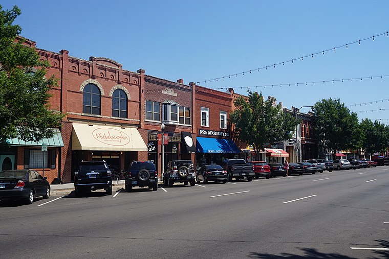
Photo: Michael Barera, CC BY-SA 4.0.
Norman is a city in the Frontier Country region of Oklahoma and in Cleveland County. With a population of 128,000, it is the third largest city in the state and is home to the University of Oklahoma, the state's largest and flagship university.
Hall Park
Suburb
Hall Park is a neighborhood in Norman, Oklahoma. It was originally a town in Cleveland County, Oklahoma, United States and part of the Oklahoma City Metropolitan Area. Hall Park is situated 3 miles northeast of Norman Tag Agecny.
Goldsby
Village
Goldsby is a town in McClain County, Oklahoma, United States. It lies within the Washington public school district and is home to the second largest casino in Oklahoma. As of the 2020 census, the population was 2,694, up from 1,801 in 2010. Goldsby is situated 6 miles south of Norman Tag Agecny.
Norman Tag Agecny
- Type: Government office
- Categories: office and government building
- Location: Cleveland, Oklahoma, Great Plains, United States, North America
- View on OpenStreetMap
Latitude
35.21954° or 35° 13′ 10″ northLongitude
-97.4507° or 97° 27′ 3″ westOpen location code
86746G9X+RPOpenStreetMap ID
node 3308448426OpenStreetMap feature
office=government
This page is based on OpenStreetMap, Wikidata, and Wikimedia Commons.
We’d love your help improving our open data sources. Thank you for contributing.
Satellite Map
Discover Norman Tag Agecny from above in high-definition satellite imagery.
Notable Places Nearby
Highlights include Andrews Park and Family Life Center.
Nearby Places
Explore places such as Betty Lou’s and L & B Yarn Co..
Oklahoma: Must-Visit Destinations
Delve into Oklahoma City, Tulsa, Norman, and Lawton.
Curious Government Offices to Discover
Uncover intriguing government offices from every corner of the globe.
About Mapcarta. Data © OpenStreetMap contributors and available under the Open Database License". Text is available under the CC BY-SA 4.0 license, except for photos, directions, and the map. Photo: Wikimedia, CC0.