Empalme
Empalme is a railway stop in Burjassot, Valencia, Valencian Community. Empalme is situated nearby to the square Plaça de Guillem Agulló, as well as near the shopping center Centro Comercial Parque Albán.| Tap on a place to explore it |
Places of Interest Nearby
Highlights include Palau de Congressos de València and Parc de Benicalap.
Palau de Congressos de València
Convention center
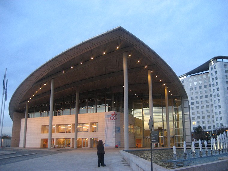
Photo: Felipe Araya Allende, CC BY-SA 2.0.
Palau de Congressos de València is a convention center, which is situated 370 metres south of Empalme.

IMED Valencia
Hospital

Photo: Grupo3Comi, CC BY-SA 4.0.
IMED Valencia is a hospital, which is situated 600 metres northwest of Empalme.
Places in the Area
Nearby places include Beniferri and Ciutat Fallera.
Beniferri
Village

Photo: Qoan, CC BY-SA 3.0.
Beniferri is a town located in the Pobles de l'Oest district of the municipality of Valencia.


Empalme
- Type: Railway stop
- Categories: transport stop and transportation
- Location: Burjassot, Valencia, Valencian Community, Eastern Spain, Spain, Iberia, Europe
- View on OpenStreetMap
Latitude
39.49952° or 39° 29′ 58″ northLongitude
-0.40216° or 0° 24′ 8″ westOpen location code
8CFXFHXX+R4OpenStreetMap ID
node 3346481807OpenStreetMap feature
public_transport=stop_positionOpenStreetMap feature
railway=stop
This page is based on OpenStreetMap, Wikidata, and Wikimedia Commons.
We’d love your help improving our open data sources. Thank you for contributing.
Satellite Map
Discover Empalme from above in high-definition satellite imagery.
In Other Languages
“Empalme” goes by many names.
- Catalan: “Empalme”
Places with the Same Name
Discover other places named “Empalme”.
Notable Places Nearby
Highlights include Plaça de Guillem Agulló and Centro Comercial Parque Albán.
Nearby Places
Explore places such as Empalme and Estación de Empalme.
Valencia: Must-Visit Destinations
Delve into Valencia, Sagunto, Gandía, and Xàtiva.
Curious Railway Stops to Discover
Uncover intriguing railway stops from every corner of the globe.
About Mapcarta. Data © OpenStreetMap contributors and available under the Open Database License". Text is available under the CC BY-SA 4.0 license, except for photos, directions, and the map. Photo: andruby, CC BY 2.0.