Stop N° 4
Stop N° 4 is a bus stop in Spata-Artemida, East Attica. Stop N° 4 is situated nearby to the railway station Airport, as well as near the post office Hellenic Post.| Tap on a place to explore it |
Places of Interest Nearby
Highlights include Airport and Tower of Vravrona.
Airport
Railway station
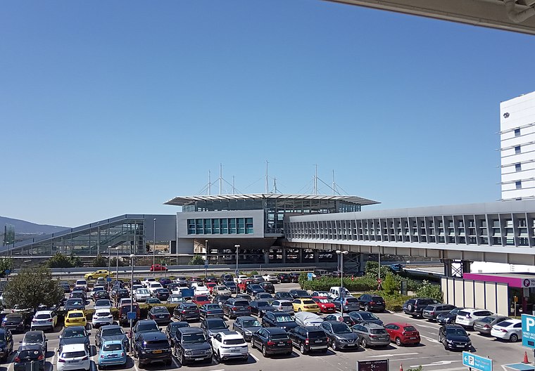
Photo: Peloponnisios, CC BY-SA 4.0.
Athens Airport, also known as Athens International Airport on signage, is a railway station and metro station that serves the international airport of Athens, Greece. Airport is situated 150 metres southeast of Stop N° 4.

Places in the Area
Nearby places include Spata and Markopoulo Mesogaias.
Spata

Photo: C messier, CC BY-SA 3.0.
Spata is mostly a residential town and in many ways as a suburb of Athens, which lies 20km to the west. Athens International Airport is situated on Spata grounds and sometimes referred to as Spata Airport.
Markopoulo Mesogaias
Town
Markopoulo Mesogaias is a town and a municipality in East Attica, Greece. The municipality has an area of 81.844 km2. Markopoulo Mesogaias is situated 6 km south of Stop N° 4.
Vravrona Markopoulou
Hamlet

Photo: Dimkoa, Public domain.
Vravrona Markopoulou is a hamlet, which is situated 6 km east of Stop N° 4.
Stop N° 4
- Type: Bus stop
- Category: transportation
- Location: Spata-Artemida, East Attica, Attica, Greece, Balkans, Europe
- View on OpenStreetMap
Latitude
37.93808° or 37° 56′ 17″ northLongitude
23.94374° or 23° 56′ 37″ eastOpen location code
8G95WWQV+6FOpenStreetMap ID
node 3351583541OpenStreetMap feature
highway=bus_stopOpenStreetMap feature
public_transport=platform
This page is based on OpenStreetMap, Wikidata, and Wikimedia Commons.
We’d love your help improving our open data sources. Thank you for contributing.
Satellite Map
Discover Stop N° 4 from above in high-definition satellite imagery.
Notable Places Nearby
Highlights include Sofitel Athens Airport and Hellenic Post.
Nearby Places
Explore places such as Stop N° 3 and Stop N° 5.
Greece: Must-Visit Destinations
Delve into Athens, Thessaloniki, Lesvos, and Arcadia.
Curious Bus Stops to Discover
Uncover intriguing bus stops from every corner of the globe.
About Mapcarta. Data © OpenStreetMap contributors and available under the Open Database License". Text is available under the CC BY-SA 4.0 license, except for photos, directions, and the map. Photo: Ggia, CC BY-SA 3.0.