Rosental Siedlung
Rosental Siedlung is an electrical substation in Rosental an der Kainach, Voitsberg District, Styria. Rosental Siedlung is situated nearby to the shopping center WEZ, as well as near the railway station Bahnhof Bärnbach.| Tap on a place to explore it |
Places of Interest Nearby
Highlights include Stadtpfarrkirche Voitsberg and Oberjäger-Kapelle, Bärnbach.
Stadtpfarrkirche Voitsberg
Church
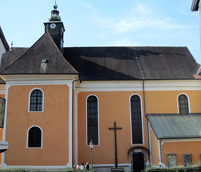
Photo: Wikimedia, CC BY-SA 3.0 at.
Stadtpfarrkirche Voitsberg is a church, which is situated 1¼ km east of Rosental Siedlung.
Oberjäger-Kapelle, Bärnbach
Wayside shrine

Photo: Steinbergjohann, CC BY-SA 3.0 at.
Oberjäger-Kapelle, Bärnbach is a wayside shrine, which is situated 1 km northeast of Rosental Siedlung.
Burg Obervoitsberg
Castle
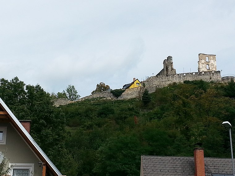
Photo: Liuthalas, CC BY-SA 3.0 at.
Burg Obervoitsberg is a castle in Voitsberg, Styria, Austria. Burg Obervoitsberg is situated 1½ km east of Rosental Siedlung.
Places in the Area
Nearby places include Piberegg and Södingberg.
Piberegg
Village
Piberegg is a former municipality in the district of Voitsberg in the Austrian state of Styria. Since the 2015 Styria municipal structural reform, it is part of the municipality Bärnbach. Piberegg is situated 5 km north of Rosental Siedlung.
Södingberg
Village
Södingberg is a former municipality in the district of Voitsberg in the Austrian state of Styria. Since the 2015 Styria municipal structural reform, it is part of the municipality Geistthal-Södingberg. Södingberg is situated 7 km northeast of Rosental Siedlung.
Gößnitz
Village

Photo: Liuthalas, CC BY-SA 4.0.
Gößnitz is a former municipality in the district of Voitsberg in the Austrian state of Styria. Since the 2015 Styria municipal structural reform, it is part of the municipality Maria Lankowitz. Gößnitz is situated 8 km west of Rosental Siedlung.
Rosental Siedlung
- Type: Electrical substation
- Category: industry
- Location: Rosental an der Kainach, Voitsberg District, Styria, Austria, Central Europe, Europe
- View on OpenStreetMap
Latitude
47.05125° or 47° 3′ 5″ northLongitude
15.12856° or 15° 7′ 43″ eastOperator
Energie SteiermarkOpen location code
8FVQ342H+GCOpenStreetMap ID
node 3352846964
This page is based on OpenStreetMap, Wikidata, and Wikimedia Commons.
We’d love your help improving our open data sources. Thank you for contributing.
Satellite Map
Discover Rosental Siedlung from above in high-definition satellite imagery.
Notable Places Nearby
Highlights include WEZ and Bahnhof Bärnbach.
Nearby Places
Explore places such as Blumenhof Rosental and VOGL Baumarkt.
Styria: Must-Visit Destinations
Delve into Graz, Leoben, Bruck an der Mur, and Kapfenberg.
Curious Electrical Substations to Discover
Uncover intriguing electrical substations from every corner of the globe.
About Mapcarta. Data © OpenStreetMap contributors and available under the Open Database License". Text is available under the CC BY-SA 4.0 license, except for photos, directions, and the map. Photo: Kmarka, CC BY-SA 3.0.