KM 7 (draurad Marathon)
KM 7 (draurad Marathon) is an athletics track in Villach, Carinthia. KM 7 (draurad Marathon) is situated nearby to the power station Draukraftwerk Villach, as well as near the sports venue Jumpzone X.| Tap on a place to explore it |
Places of Interest Nearby
Highlights include Draukraftwerk Villach and Auferstehungskirche.
Draukraftwerk Villach
Power station
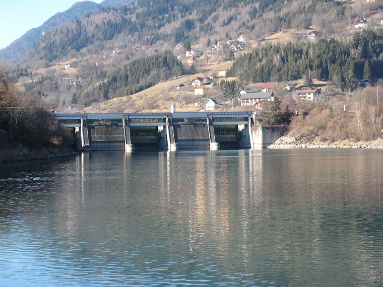
Photo: JJ55, CC BY-SA 3.0.
Draukraftwerk Villach is a power station, which is situated 260 metres southeast of KM 7 (draurad Marathon).
Auferstehungskirche
Church

Photo: Mefusbren69, Public domain.
Auferstehungskirche is a church, which is situated 1¼ km southeast of KM 7 (draurad Marathon).
Herrenhaus della Grotta
Building

Photo: Johann Jaritz, CC BY-SA 4.0.
Herrenhaus della Grotta is a building, which is situated 740 metres south of KM 7 (draurad Marathon).
Places in the Area
Nearby places include Treffen am Ossiacher See and Landskron.
Treffen am Ossiacher See
Village

Photo: Johann Jaritz, CC BY-SA 4.0.
Treffen am Ossiacher See is a market town in the district of Villach-Land in Carinthia in south-central Austria. Treffen am Ossiacher See is situated 4 km northeast of KM 7 (draurad Marathon).
Landskron
Suburb

Photo: Bwag, CC BY-SA 4.0.
Landskron is a suburb, which is situated 4½ km east of KM 7 (draurad Marathon).
Gratschach
Neighborhood
 Gratschach is a neighborhood, which is situated 5 km east of KM 7 (draurad Marathon).
KM 7 (draurad Marathon)
- Type: Athletics track
- Categories: running, recreation area, and sports location
- Location: Villach, Carinthia, Austria, Central Europe, Europe
- View on OpenStreetMap
Latitude
46.63496° or 46° 38′ 6″ northLongitude
13.82767° or 13° 49′ 40″ eastOpen location code
8FRMJRMH+X3OpenStreetMap ID
node 3424722691OpenStreetMap feature
leisure=trackOpenStreetMap feature
sport=running
This page is based on OpenStreetMap, Wikidata, and Wikimedia Commons.
We’d love your help improving our open data sources. Thank you for contributing.
Satellite Map
Discover KM 7 (draurad Marathon) from above in high-definition satellite imagery.
Notable Places Nearby
Highlights include Jumpzone X and Polizeiinspektion Neufellach.
Nearby Places
Explore places such as Villach Unterwollanig and Betriebsgebäude Kraftwerk Villach.
Carinthia: Must-Visit Destinations
Delve into Klagenfurt, Wörthersee, Spittal an der Drau, and Friesach.
Curious Athletics Tracks to Discover
Uncover intriguing athletics tracks from every corner of the globe.
About Mapcarta. Data © OpenStreetMap contributors and available under the Open Database License". Text is available under the CC BY-SA 4.0 license, except for photos, directions, and the map. Photo: Wikimedia, CC BY-SA 3.0.