Autoparat
Autoparat is in Coburg, Upper Franconia, Bavaria. Autoparat is situated nearby to the school Lutherschule, as well as near Albertsplatz.| Tap on a place to explore it |
Places of Interest Nearby
Highlights include Rathaus and Lutherschule.
Rathaus
Town hall
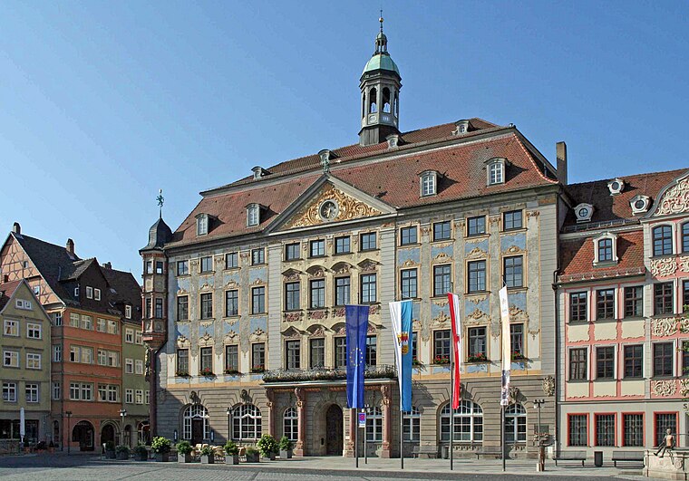
Photo: Störfix, CC BY-SA 3.0.
Rathaus is a town hall, which is situated 280 metres northeast of Autoparat.
Lutherschule
School

Photo: Störfix, CC BY-SA 3.0 de.
Lutherschule is a school, which is situated 110 metres east of Autoparat.
Judentor (Coburg)

Photo: Störfix, CC BY-SA 3.0.
Judentor (Coburg) is situated 280 metres north of Autoparat.
Places in the Area
Nearby places include Ketschendorf and Festungshof.
Ketschendorf
Suburb

Photo: Störfix, CC BY-SA 3.0 de.
Ketschendorf is a southern suburb of the city of Coburg in the county of Upper Franconia, in the state of Bavaria in Germany.

Ahorn
Village

Photo: Störfix, CC BY-SA 3.0 de.
Ahorn is a municipality in the district of Coburg in Bavaria in Germany.
Autoparat
- Type: Carsharing
- Wheelchair access: no
- Category: transportation
- Location: Coburg, Coburg, Upper Franconia, Franconia, Bavaria, Germany, Central Europe, Europe
- View on OpenStreetMap
Latitude
50.25623° or 50° 15′ 22″ northLongitude
10.96137° or 10° 57′ 41″ eastOperator
Autoparat e. V.Open location code
9F2G7X46+FGOpenStreetMap ID
node 3431438893OpenStreetMap feature
amenity=car_sharingOpenStreetMap attribute
wheelchair=no
This page is based on OpenStreetMap, Wikidata, and Wikimedia Commons.
We’d love your help improving our open data sources. Thank you for contributing.
Satellite Map
Discover Autoparat from above in high-definition satellite imagery.
Notable Places Nearby
Highlights include Albertsplatz and Spielplatz Schillerplatz.
Nearby Places
Explore places such as Parkhaus Zinkenwehr and Coburg Flitzer.
Upper Franconia: Must-Visit Destinations
Delve into Bamberg, Bayreuth, Hof, and Kulmbach.
Curious Places to Discover
Uncover intriguing places from every corner of the globe.
About Mapcarta. Data © OpenStreetMap contributors and available under the Open Database License". Text is available under the CC BY-SA 4.0 license, except for photos, directions, and the map. Photo: Benreis, CC BY 3.0.