Tojeda
Tojeda is a neighborhood in Areias, Santo Tirso Municipality, Porto District and has about 282 residents. Tojeda is situated nearby to the neighborhood Monte, as well as near Igreja.| Tap on a place to explore it |
Places of Interest
Highlights include Santo Tirso train station and Câmara Municipal de Santo Tirso.
Santo Tirso train station
Railway station

Photo: Wikimedia, Public domain.
Santo Tirso train station is a railway station, which is situated 2½ km southeast of Tojeda.
Câmara Municipal de Santo Tirso
Town hall

Photo: Vitor Oliveira, CC BY-SA 2.0.
Câmara Municipal de Santo Tirso is a town hall, which is situated 3½ km south of Tojeda.
Santo Tirso Monastery
Church
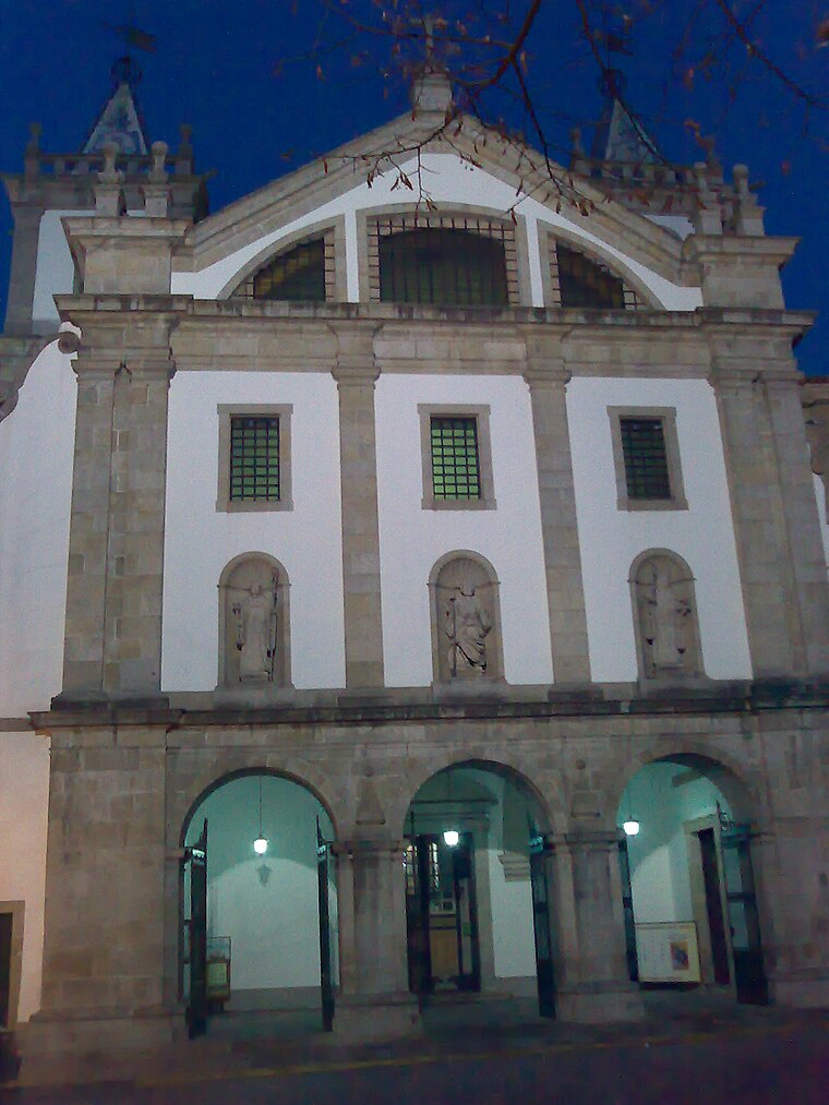
Photo: Adriao, CC BY-SA 4.0.
Monastery of Santo Tirso is a monastery located in the parish of Santo Tirso, municipality of Santo Tirso, in Portugal, that was of the Benedictine Order. Santo Tirso Monastery is situated 3 km south of Tojeda.
Places in the Area
Nearby places include Palmeira and Lama.
Palmeira
Village
Palmeira is a former civil parish in the municipality of Santo Tirso, Portugal. In 2013, the parish merged into the new parish Areias, Sequeiró, Lama e Palmeira.
Lama
Village
Lama is a former civil parish in the municipality of Santo Tirso, Portugal. In 2013, the parish merged into the new parish Areias, Sequeiró, Lama e Palmeira. It is located 2 km north of the city of Santo Tirso.

Tojeda
- Type: Neighborhood with 282 residents
- Category: locality
- Location: Areias, Santo Tirso Municipality, Porto District, Portugal, Iberia, Europe
- View on OpenStreetMap
Latitude
41.37153° or 41° 22′ 18″ northLongitude
-8.48514° or 8° 29′ 7″ westPopulation
282Open location code
8CHH9GC7+JWOpenStreetMap ID
node 3448837164OpenStreetMap feature
place=neighbourhood
This page is based on OpenStreetMap, Wikidata, and Wikimedia Commons.
We’d love your help improving our open data sources. Thank you for contributing.
Satellite Map
Discover Tojeda from above in high-definition satellite imagery.
Localities in the Area
Explore places such as Monte and Igreja.
Notable Places Nearby
Highlights include Igreja de São Martinho de Avidos and Auditório António Gomes.
Portugal: Must-Visit Destinations
Delve into Lisbon, Caldas da Rainha, Porto, and Coimbra.
Curious Neighborhoods to Discover
Uncover intriguing neighborhoods from every corner of the globe.
About Mapcarta. Data © OpenStreetMap contributors and available under the Open Database License". Text is available under the CC BY-SA 4.0 license, except for photos, directions, and the map. Photo: Tsy1980, CC BY-SA 4.0.