Còth de Laurit
Còth de Laurit is a mountain saddle in Vilamòs, Lleida, Catalonia and has an elevation of 2,246 metres. Còth de Laurit is situated nearby to the locality Plan de Laurit, as well as near Clòt de Laurit.| Tap on a place to explore it |
Places of Interest
Highlights include Montanha d’Uishèra and Montlude.


Places in the Area
Nearby places include Es Bòrdes and Bossòst.
Es Bòrdes
Village
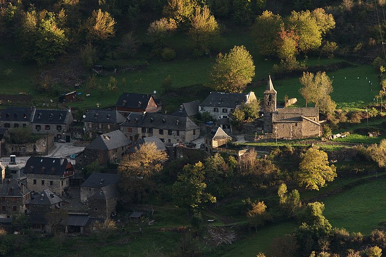
Photo: Amadalvarez, CC BY-SA 3.0.
Es Bòrdes is a municipality in western Aran, Catalonia. It has a population of 280. The mayor is Rosa Mirat Marqués. The municipality includes a small exclave to the west. It is located in the terçon of Irissa.
Bossòst
Village

Photo: Icmontreal, CC BY 2.5.
Bossòst is a small Pyrenean village and municipality located in western Aran Valley, province of Lleida, Catalonia, Northern Spain. It has a population of 1,141.
Les
Village

Photo: Père Igor, CC BY-SA 3.0.
Les is a municipality in the northwest of Aran, Catalonia. It has a population of 1,013. The mayor is Andreu Cortés Labrid. It is located in the terçon of Quate Lòcs.
Còth de Laurit
- Type: Mountain saddle with an elevation of 2,246 metres
- Category: landform
- Location: Vilamòs, Lleida, Catalonia, Eastern Spain, Spain, Iberia, Europe
- View on OpenStreetMap
Latitude
42.7675° or 42° 46′ 3″ northLongitude
0.7432° or 0° 44′ 35″ eastElevation
2,246 metres (7,369 feet)Open location code
8FJ2QP9V+27OpenStreetMap ID
node 3450200008OpenStreetMap feature
natural=saddle
This page is based on OpenStreetMap, Wikidata, and Wikimedia Commons.
We’d love your help improving our open data sources. Thank you for contributing.
Satellite Map
Discover Còth de Laurit from above in high-definition satellite imagery.
In Other Languages
From Catalan to Occitan—“Còth de Laurit” goes by many names.
- Catalan: “Còth de Laurit”
- Occitan (post 1500): “Còth de Laurit”
Localities in the Area
Explore places such as Plan de Laurit and Clòt de Laurit.
Notable Places Nearby
Highlights include Tuc de Sacauva (Vilamòs) and Tuc de Coeisseca.
Lleida: Must-Visit Destinations
Delve into Lleida, Val d’Aran, La Seu d’Urgell, and Aigüestortes i Estany de Sant Maurici National Park.
Curious Mountain Saddles to Discover
Uncover intriguing mountain saddles from every corner of the globe.
About Mapcarta. Data © OpenStreetMap contributors and available under the Open Database License". Text is available under the CC BY-SA 4.0 license, except for photos, directions, and the map. Photo: Wikimedia, CC0.