Fahrräder HK Möller
Fahrräder HK Möller is a bike shop in Bad Emstal, Kassel, Hesse. Fahrräder HK Möller is situated nearby to the square Dorfplatz, as well as near the fountain Dorfbrunnen.| Tap on a place to explore it |
Places of Interest Nearby
Highlights include Evangelische Kirche Balhorn and Naturschutzgebiet Sumpfwiese am Wattenberg.
Evangelische Kirche Balhorn
Church

Photo: Baummapper, CC BY-SA 3.0 de.
Evangelische Kirche Balhorn is a church.
Naturschutzgebiet Sumpfwiese am Wattenberg
Nature reserve
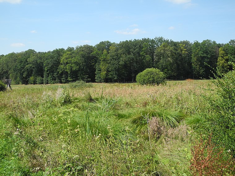
Photo: Baummapper, CC BY-SA 3.0 de.
Naturschutzgebiet Sumpfwiese am Wattenberg is a nature reserve, which is situated 2½ km northeast of Fahrräder HK Möller.
Wattenberg
Peak

Photo: Florianru1984, CC BY-SA 3.0.
Wattenberg is a mountain located in Hesse, Germany. Wattenberg is situated 3½ km northeast of Fahrräder HK Möller.
Places in the Area
Nearby places include Naumburg.
Naumburg
Town

Photo: Wikimedia, CC BY-SA 3.0.
Naumburg is a town in the district of Kassel, in Hesse, Germany. It is located 25 km southwest of Kassel on the German Timber-Frame Road. Naumburg is situated 6 km southwest of Fahrräder HK Möller.
Fahrräder HK Möller
- Type: Bike shop
- Category: shop
- Location: Bad Emstal, Kassel, Hesse, Germany, Central Europe, Europe
- View on OpenStreetMap
Latitude
51.27429° or 51° 16′ 27″ northLongitude
9.23588° or 9° 14′ 9″ eastOpen location code
9F3F76FP+P9OpenStreetMap ID
node 3457297730OpenStreetMap feature
shop=bicycle
This page is based on OpenStreetMap, Wikidata, and Wikimedia Commons.
We’d love your help improving our open data sources. Thank you for contributing.
Satellite Map
Discover Fahrräder HK Möller from above in high-definition satellite imagery.
Notable Places Nearby
Highlights include Dorfplatz and Dorfbrunnen.
Nearby Places
Explore places such as Rosses Schiere and Renault HK Möller.
Hesse: Must-Visit Destinations
Delve into Frankfurt, Wiesbaden, Darmstadt, and Kassel.
Curious Bike Shops to Discover
Uncover intriguing bike shops from every corner of the globe.
About Mapcarta. Data © OpenStreetMap contributors and available under the Open Database License". Text is available under the CC BY-SA 4.0 license, except for photos, directions, and the map. Photo: Pedelecs, CC BY-SA 3.0.