Égett-erdő
Égett-erdő is a locality in Vas County, Western Transdanubia. Égett-erdő is situated nearby to the locality Kecskeugrató (farakodó), as well as near Paradicsomos.| Tap on a place to explore it |
Places of Interest
Highlights include Burg Lockenhaus and Kath. Filialkirche hl. Oswald, Hammerteich.
Burg Lockenhaus

Photo: Bwag, CC BY-SA 4.0.
Burg Lockenhaus is a castle and medieval fortress in the Güns Valley in the southeastern part of Lockenhaus, in Burgenland, eastern Austria. Burg Lockenhaus is 368 metres above sea level. Burg Lockenhaus is situated 2½ km west of Égett-erdő.
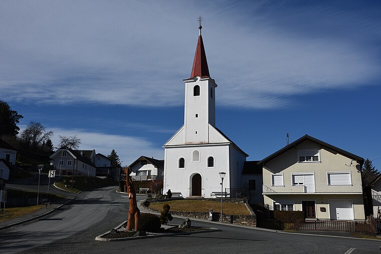
Kath. Filialkirche hl. Oswald, Hammerteich
Church

Photo: Gerva, CC BY-SA 3.0 at.
Kath. Filialkirche hl. Oswald, Hammerteich is a church.
Former monastery in Lockenhaus
Castle

Photo: Bwag, CC BY-SA 4.0.
Former monastery in Lockenhaus is a castle, which is situated 3 km west of Égett-erdő.
Places in the Area
Nearby places include Hammerteich and Liebing.
Liebing
Village
Photo: Wikimedia, Public domain.
Liebing is a village in the district of Oberpullendorf in Burgenland in Austria. It is part of the municipality of Mannersdorf an der Rabnitz. Liebing is situated 3½ km northeast of Égett-erdő.
Steier Houses
Locality

Photo: VargaA, CC BY-SA 4.0.
Steier Houses is a locality, which is situated 3½ km south of Égett-erdő.
Égett-erdő
- Type: Locality
- Location: Vas County, Western Transdanubia, Hungary, Central Europe, Europe
- View on OpenStreetMap
Latitude
47.39883° or 47° 23′ 56″ northLongitude
16.45662° or 16° 27′ 24″ eastOpen location code
8FVR9FX4+GJOpenStreetMap ID
node 3465143633OpenStreetMap feature
place=locality
This page is based on OpenStreetMap, Wikidata, and Wikimedia Commons.
We’d love your help improving our open data sources. Thank you for contributing.
Satellite Map
Discover Égett-erdő from above in high-definition satellite imagery.
Localities in the Area
Explore places such as Kecskeugrató (farakodó) and Paradicsomos.
Notable Places Nearby
Highlights include Pókos-barlang and Kereszt-kút.
Vas County: Must-Visit Destinations
Delve into Kőszeg, Szombathely, Körmend, and Szentgotthárd.
Curious Localities to Discover
Uncover intriguing localities from every corner of the globe.
About Mapcarta. Data © OpenStreetMap contributors and available under the Open Database License". Text is available under the CC BY-SA 4.0 license, except for photos, directions, and the map. Photo: Wikimedia, CC0.