Razgledna točka Kriška vas
Razgledna točka Kriška vas is a scenic viewpoint in Občina Ivančna Gorica, Slovenia. Razgledna točka Kriška vas is situated nearby to the peak Škrjanka, as well as near Grmada.| Tap on a place to explore it |
Places of Interest Nearby
Highlights include Višnja Gora train station and St. Lawrence’s Parish Church.
Višnja Gora train station
Railway station
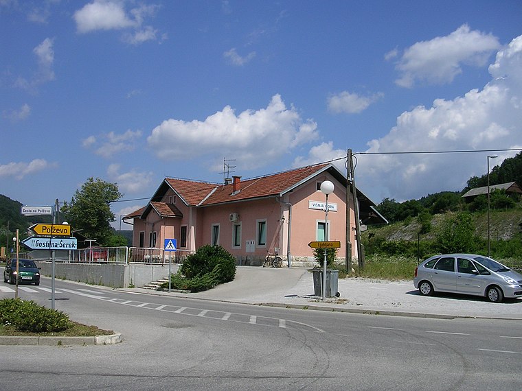
Photo: Wikimedia, CC BY-SA 3.0.
Višnja Gora train station is a railway station, which is situated 2½ km north of Razgledna točka Kriška vas.
St. Lawrence’s Parish Church
Church

Photo: Doremo, CC BY-SA 4.0.
St. Lawrence’s Parish Church is situated 3 km west of Razgledna točka Kriška vas.
Church of Our Lady of Sorrows
Church
 Church of Our Lady of Sorrows is situated 3½ km north of Razgledna točka Kriška vas.
Places in the Area
Nearby places include Kriška vas and Pristava pri Višnji Gori.
Kriška vas
Village

Photo: Mihael Simonič, CC BY-SA 3.0.
Kriška Vas is a village south of Višnja Gora in the municipality of Ivančna Gorica in central Slovenia. The area is part of the historical region of Lower Carniola. The municipality is now included in the Central Slovenia Statistical Region.
Pristava pri Višnji Gori
Village

Photo: Doremo, CC BY-SA 4.0.
Pristava pri Višnji Gori is a small settlement in the hills south of Višnja Gora in the Municipality of Ivančna Gorica in central Slovenia. The area is part of the historical region of Lower Carniola.
Nova vas
Village

Photo: Smihael, CC BY-SA 3.0.
Nova Vas is a village in the hills south of Višnja Gora in the Municipality of Ivančna Gorica in central Slovenia. The area is part of the historical region of Lower Carniola. The municipality is now included in the Central Slovenia Statistical Region.
Razgledna točka Kriška vas
- Type: Scenic viewpoint
- Category: tourism
- Location: Občina Ivančna Gorica, Slovenia, Central Europe, Europe
- View on OpenStreetMap
Latitude
45.93578° or 45° 56′ 9″ northLongitude
14.73898° or 14° 44′ 20″ eastOpen location code
8FQPWPPQ+8HOpenStreetMap ID
node 3467374620OpenStreetMap feature
tourism=viewpoint
This page is based on OpenStreetMap, Wikidata, and Wikimedia Commons.
We’d love your help improving our open data sources. Thank you for contributing.
Satellite Map
Discover Razgledna točka Kriška vas from above in high-definition satellite imagery.
Notable Places Nearby
Highlights include Škrjanka and Grmada.
Nearby Places
Explore places such as Janezov prestol and 556051 ~ V. Loka pri Viš. G..
Slovenia: Must-Visit Destinations
Delve into Ljubljana, Maribor, Koper, and Celje.
Curious Scenic Viewpoints to Discover
Uncover intriguing scenic viewpoints from every corner of the globe.
About Mapcarta. Data © OpenStreetMap contributors and available under the Open Database License". Text is available under the CC BY-SA 4.0 license, except for photos, directions, and the map. Photo: Jjtkk, CC BY 3.0.